
The Gardan i Kaftar Hike In Tajikistan’s Rasht Valley
Updated in February 2024, The Gardan i Kaftar Hike In Tajikistan’s Rasht Valley was originally published in May 2020
I spent a chunk of last summer and fall in Tajikistan, mostly focusing on traveling in the western half of the country. The furthest east I made it in 2019? The Gardan i Kaftar Trek in the rarely visited by foreigners, Rasht Valley.
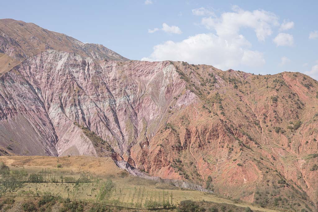
Despite all my travels in Tajikistan over the past few years, I’d never made it to the Rasht Valley (also known as the Karotegin Valley). It’s sort of a dead-end if you will, running from southwest to northeast toward Karamyk, a border crossing with Kyrgyzstan that is only bilaterally open for Tajik and Kyrgyz passport holders.
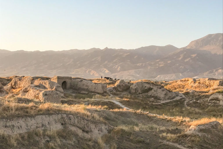
Coupled with the fact that the Rasht Valley area was heavily landmined during the 1992-1997 Tajik Civil War, the area has been left largely of the tourism radar in Tajikistan. Since the late 90s, many unexploded ordinances have been carefully removed, though areas of them still exist and are mostly signposted.
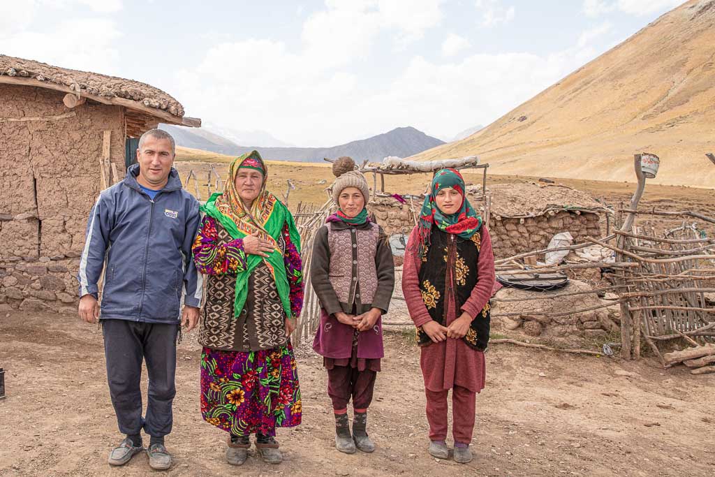
The Rasht Valley, in general, is culturally fascinating. Many of those I met traveling up the valley and on the Gardan i Kaftar hike were of Tajik-Kyrgyz blended families and impressive polyglots due to their unique backgrounds.
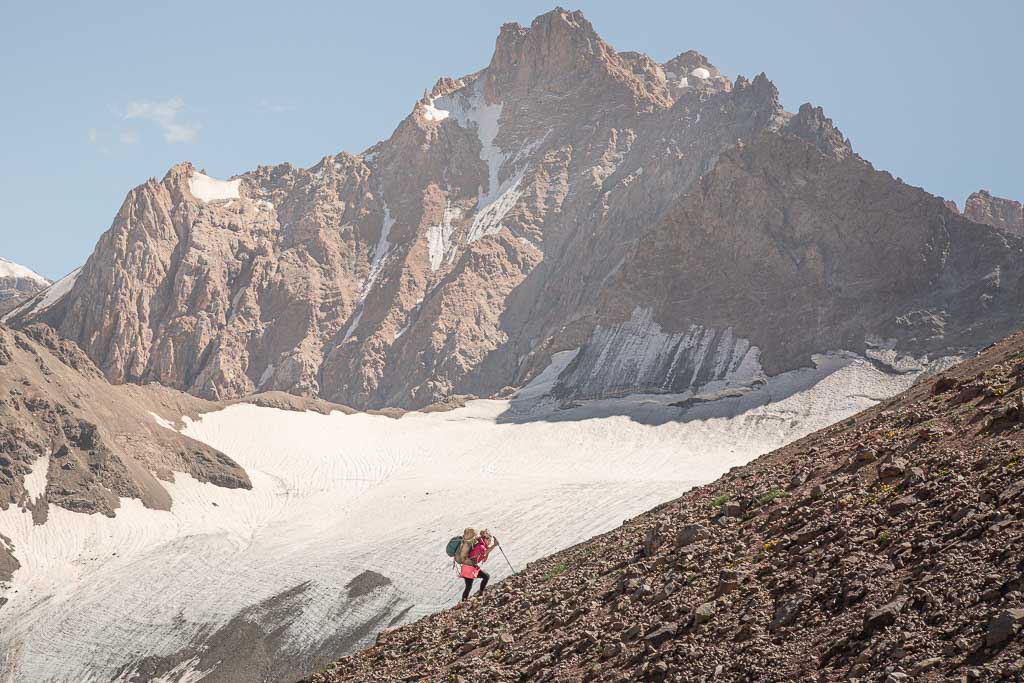
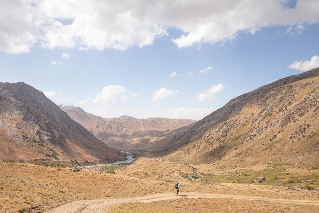
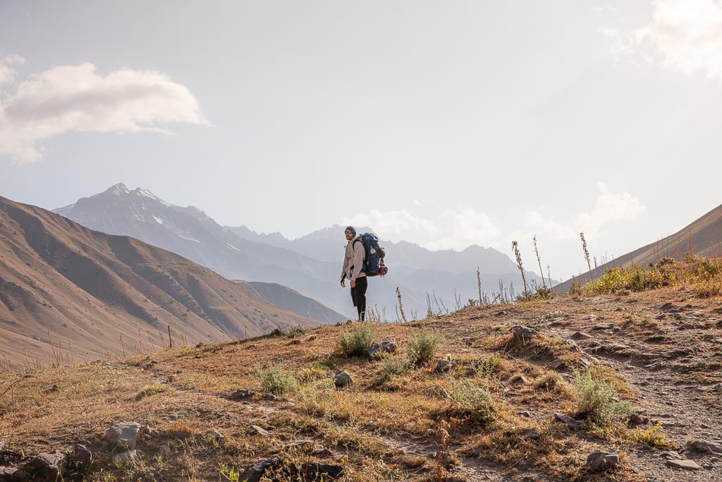
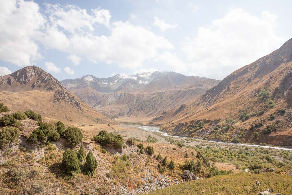
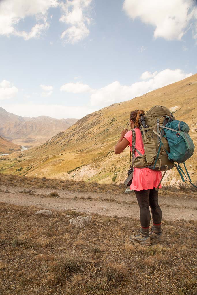
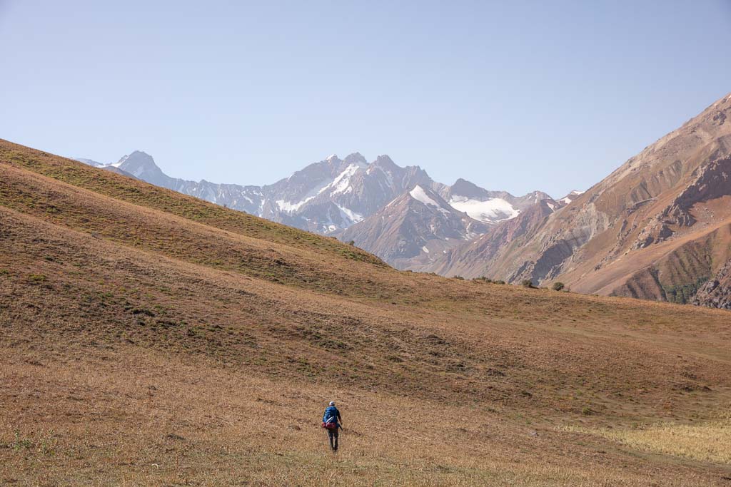
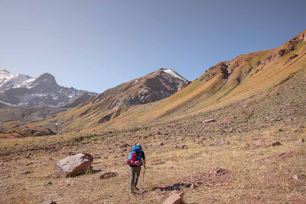
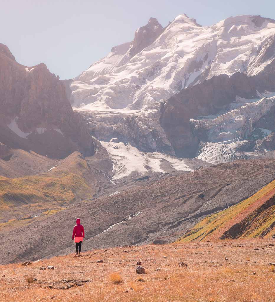
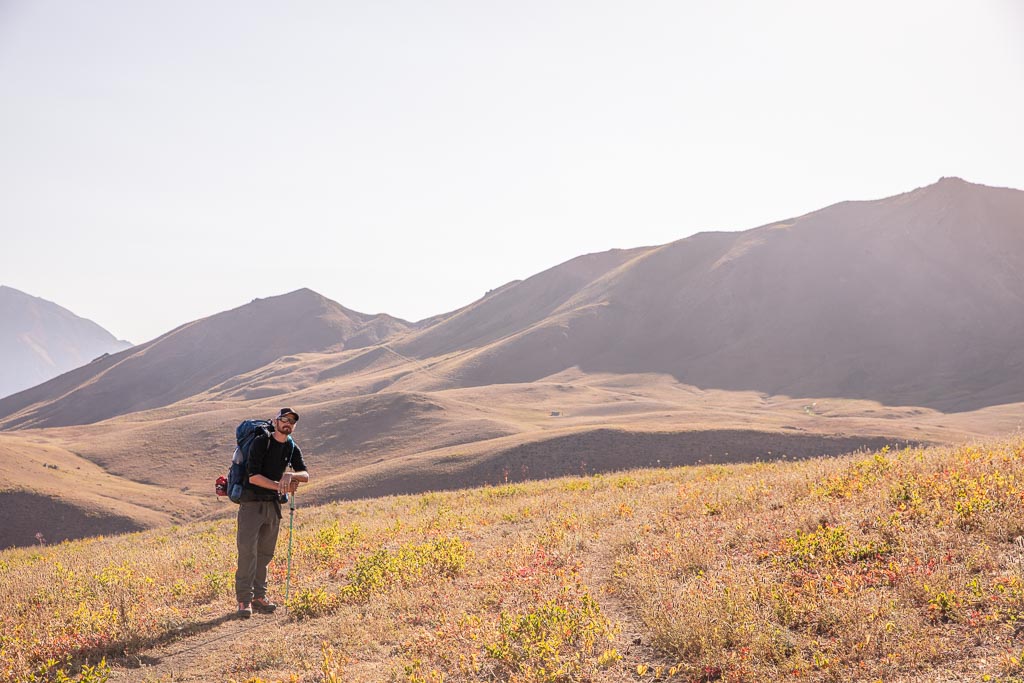
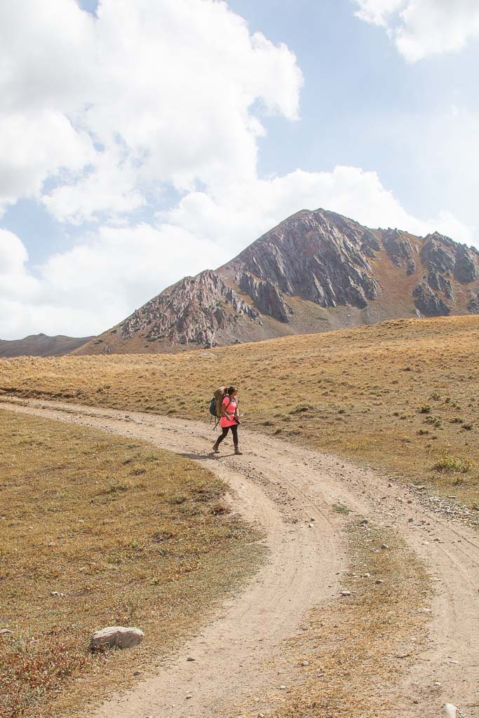
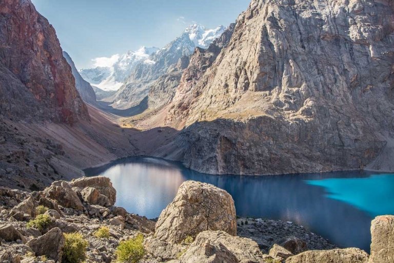
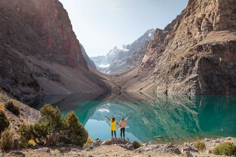
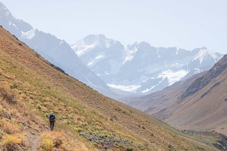
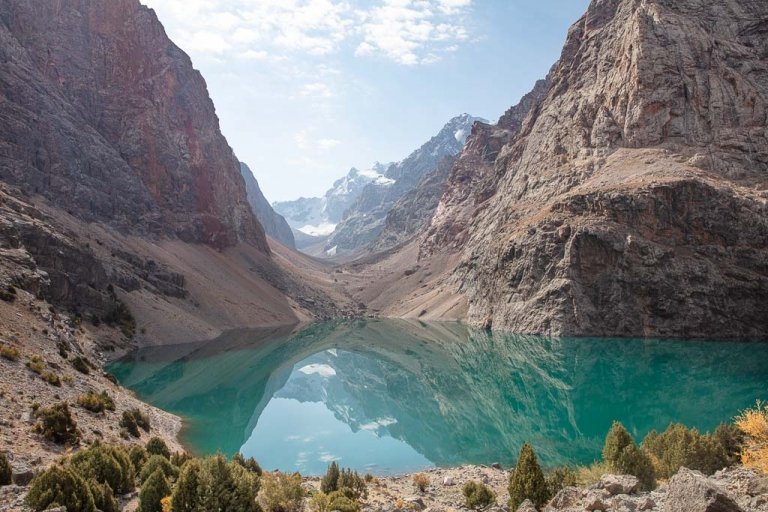
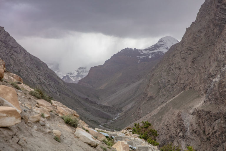
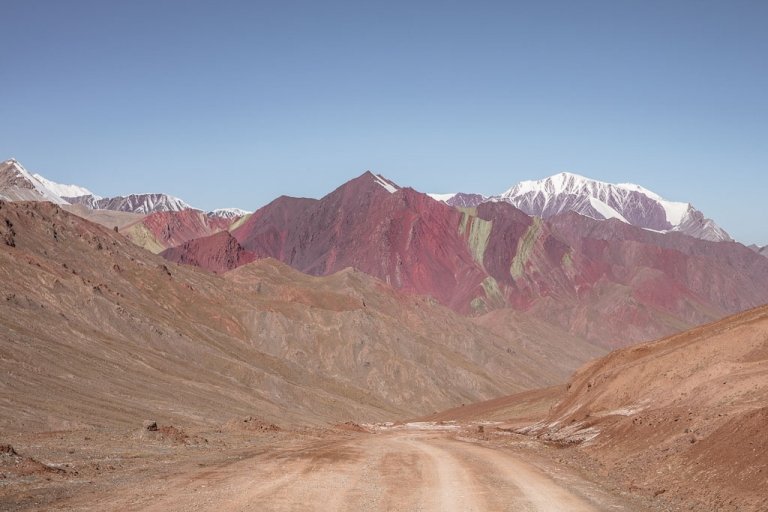
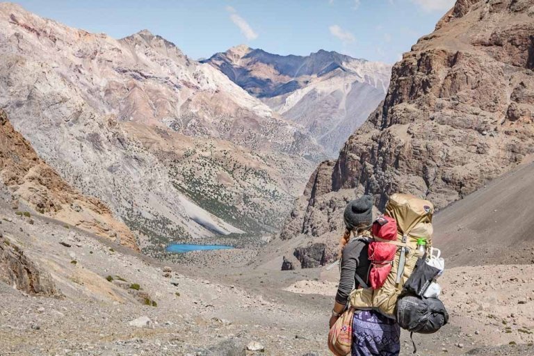
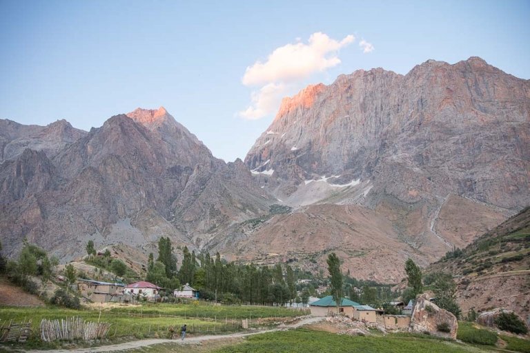
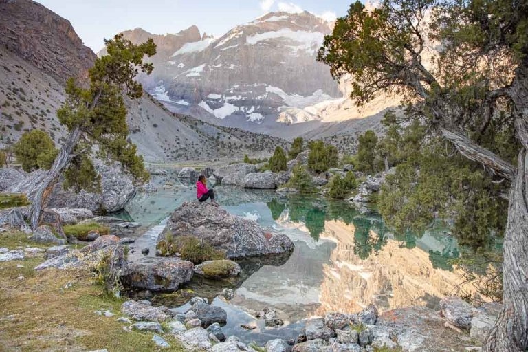
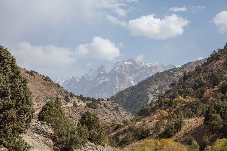
With the icy pinnacles of the Academy of Sciences Range in the distance and flower-laden valleys in the springtime, the Gardan i Kaftar Hike, taking you into the heart of the Peter the I Range is surely one of the most gorgeous, if rarely taken-on-by-foreigners treks in the country. The Gardan i Kaftar hike is definitely a challenge as we found out, due to its remoteness and raging river crossings, but for those up to the challenge and physically prepared enough this will be a trek in Tajikistan that you won’t soon forget, I know I never will– for reasons good and bad.
Less than halfway through the trek my hiking boots were stolen from the entry of my tent in the dark of night, and a pervy shepherd attempted to attack me the following day, two firsts for me in all my travels in Tajikistan. But the remoteness of these valleys and passes we crossed, the gorgeous vistas and snow-capped peaks, and the lovely people that invited us into their family homes and yurts and offered beyond their means to try and helps us outweighed that bad.
In this article, I’ll cover info you need to know about the Gardan i Kaftar hike intertwined with my experience on it, but I highly recommend you purchase Jan Bakker and Christine Oriol’s Trekking in Tajikistan book and the Bradt Tajikistan guidebook prior to your trip as it is a wealth of knowledge.
Need more info on the Rasht Valley? Check out my Rasht Valley Travel Guide
Need Travel Insurance and Evacuation Services for Tajikistan?
Start shopping for travel insurance plans over at IATI Insurance. Readers of the Adventures of Nicole get a 5% discount off your plan.
The Adventures of Nicole partners with Global Rescue to offer the world’s leading medical evacuation and security advisory services. To travel with peace of mind, shop evacuation coverage at Global Rescue.
Wanna join a group expedition on the Pamir Highway?
I will be leading a 12 day expedition down the Pamir Highway June 25-July 6, 2024. There is also an option for a 25 day Tajikistan Expedition that also includes a trek in the Fann Mountains.
Start planning: The Ultimate Tajiksitan Travel Guide
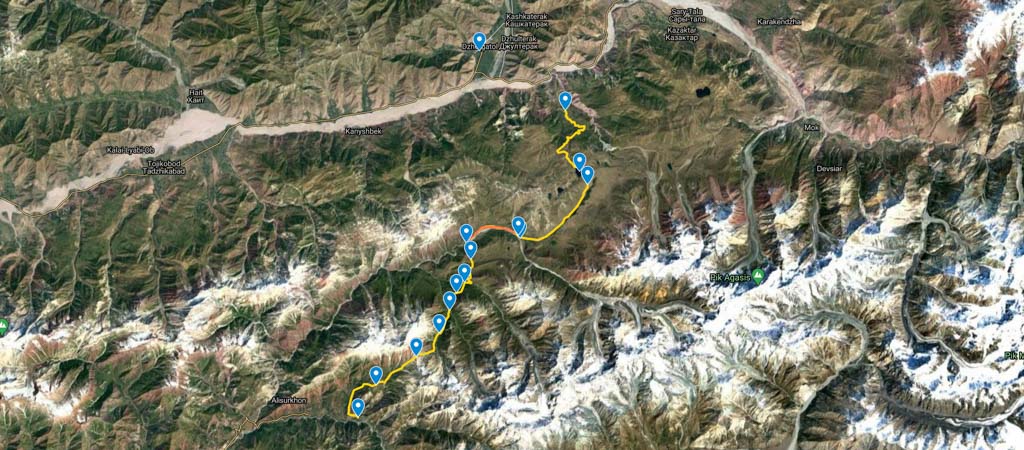
The Gardan i Kaftar Trek
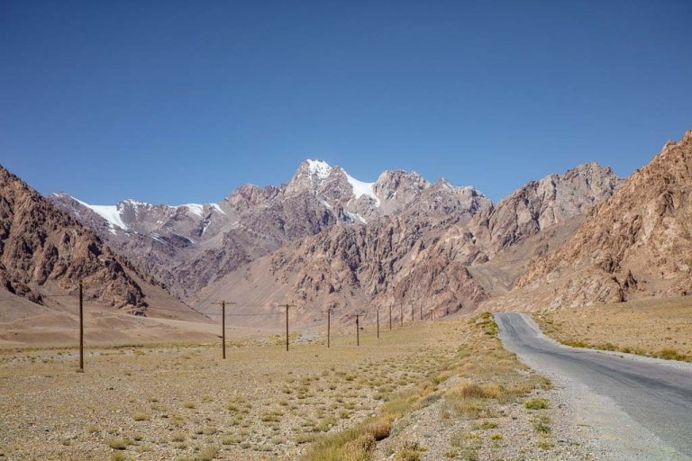
The Gardan i Kaftar Trek starts in Jelondy, a small village just south of Jirgatol, the last major town you’ll visit along the main Rasht Valley Road (the A372 that runs between Homdon, Tajikistan, and Sary Tash, Kyrgystan) before reaching the closed-to-foreigners Karamyk border post with Kyrgyzstan.
It ends at the village of Langar, located in the Khingob River Valley that is more commonly referred to as an area called ‘Sangvor’ (again, Tajik place named have a tendency to be redundant, so not to be confused with the much more popular Langar in the Tajik Wakhan Valley or the Langar in the Zeravshan Valley). Note that the Gardan i Kaftar Hike can easily be done in reverse.
- Distance: 60 kilometers
- Elevation gain: 2,645 meters
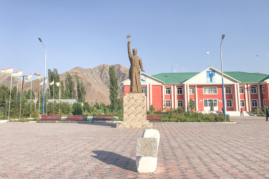
As I did the trek in the direction from northeast to southwest from Jelondy to Langar I will give the descriptions in this order. I recommend you spend a night in Jirgatol prior to taking off for the trek.
There are two homestay/guesthouses I am aware of in Jirgatol. We stayed at one in the neighborhood just a couple blocks off the main Jirgatol thoroughfare upon the recommendation by Makhim, a Jirgatol local, and fellow passenger in our Dushanbe-Jirgatol shared taxi.
On the main street through town, there’s also a hotel by the name of Hotel Safariyon with a cafeteria downstairs where you can order simple meals- outside we met Islam Safarov who helped us arrange a car to the start of the trek the following day. Islam actually guides on occasion to the Ismoil Somoni Peak Basecamp- the tallest peak in Tajikistan in the nearby Academy of Sciences Range.
Setting out on the world’s most epic road trip? Read the Pamir Highway Travel Guide to start planning
Need help narrowing it down? Check out my perfect 10 day Pamir Highway itinerary
Getting To The Trailhead
From Jirgatol you’ll need to get to the village of Jelondy. You can arrange a taxi from Jirgatol by either grabbing one for about 50 TJS from Jirgatol and get dropped off at the bridge below Jeolndy and then call Safarkhutsha (+992 931074842, Safarkhutsha only speaks Tajik and Russian) who will come down from Jelondy and pick you up for 200 TJS.
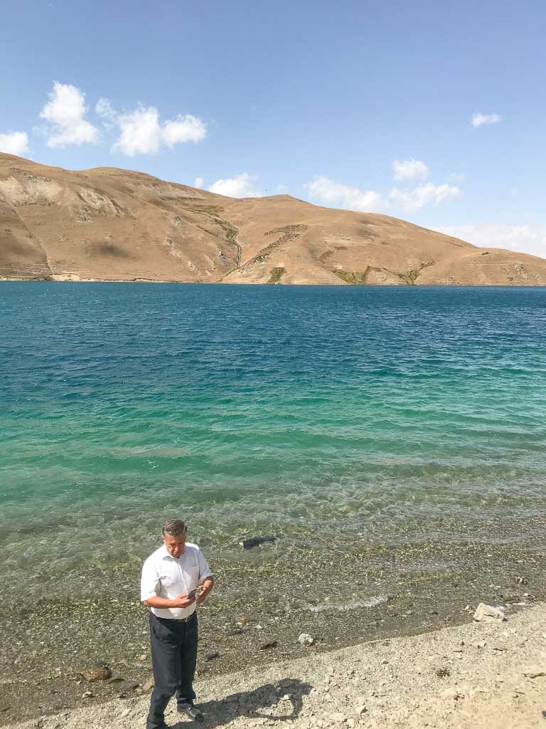
Or easier is to set up is to grab a 4WD from Jirgatol straight to Jelondy for about 300 TJS. You can, however, go by 4WD beyond Jelondy to just past the lake of Yashilkul (not to be confused with the larger and more well-known Yashilkul right off the Pamir Highway south of here) to begin trekking from the Karashura Valley for 400 TJS from Jirgatol.
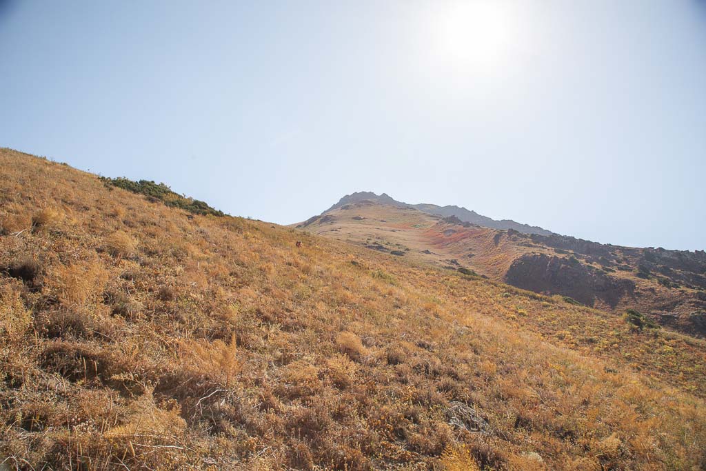
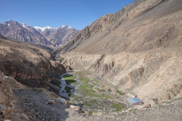
Section One: Jelondy To The Beginning Of UXO Area
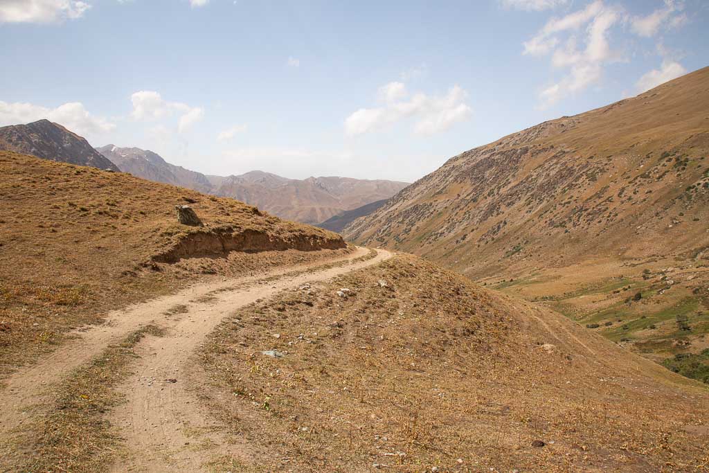
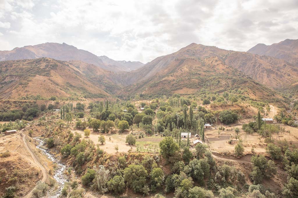
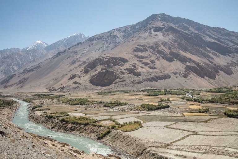
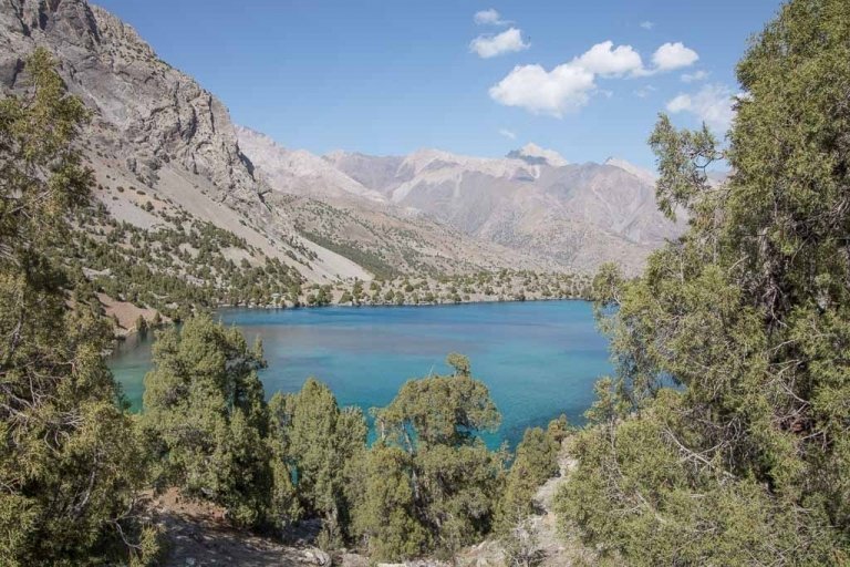
If you start from the village of Jelondy, you can either follow the road climbing up into the mountains, or you can follow a trail that meanders upwards. You will eventually join with the dirt road, and just follow it to arrive at Yashilkul Lake straight head.
This section from Jelondy to Yashilkul climbs roughly 800 meters in elevation. The road crosses over a small dam and continues along the eastern shore of Yashilkul and eventually spits you out into Karashura Valley.
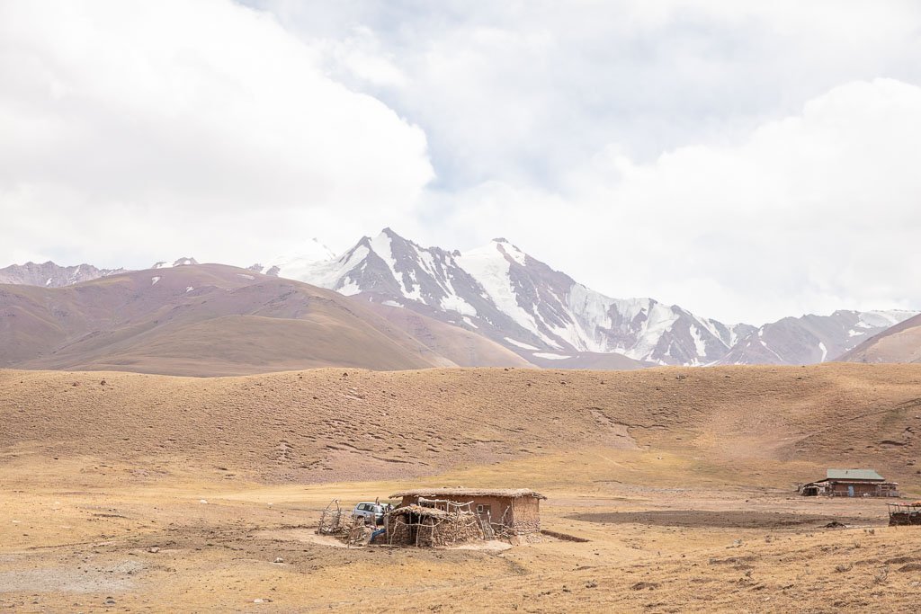
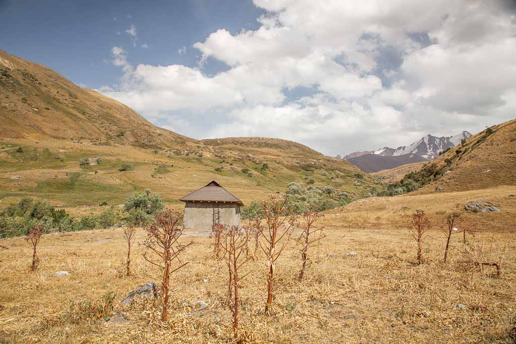
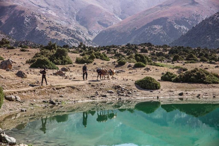
As we opted to drive beyond Jelondy to the Karashura Valley, we ended up having lunch with our driver (Jonnabek) and his family at their summer shepherd camp. Jonnabek grew up here in the summers on the Karashura Plain but now lives and works in Jirgatol. His mother and three young sisters excitedly welcomed us all in.
Looking for more hikes to do in Tajikistan? Check out my 10 best treks in Tajikistan
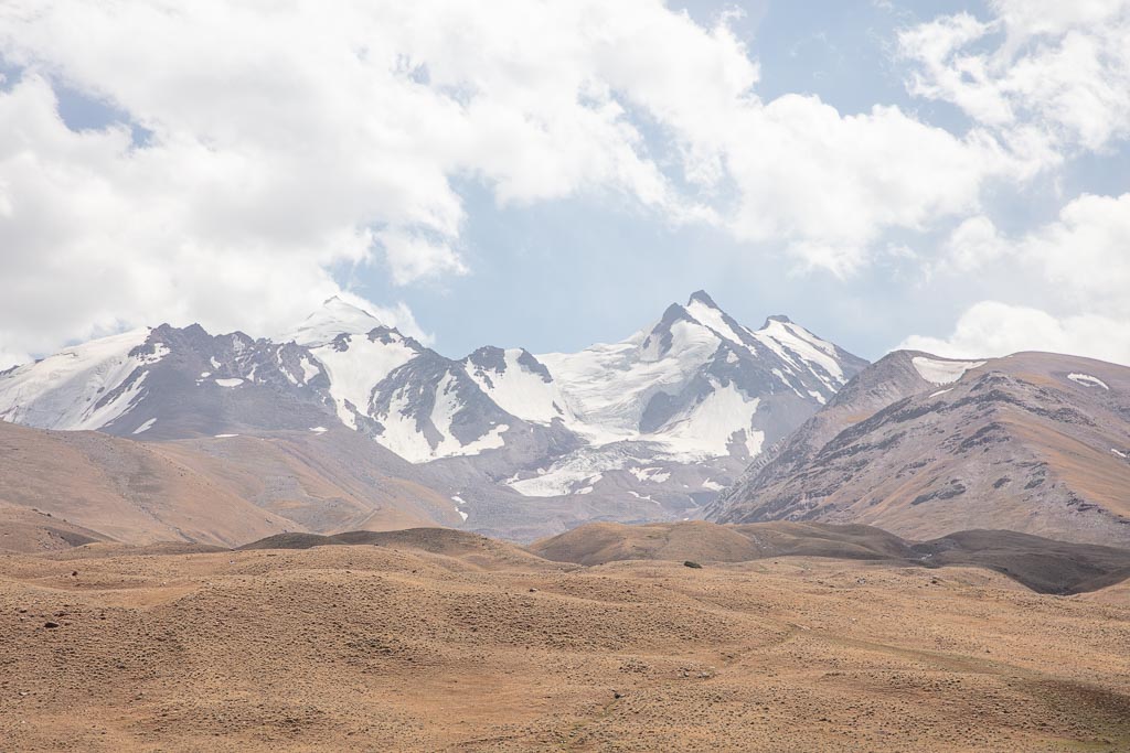
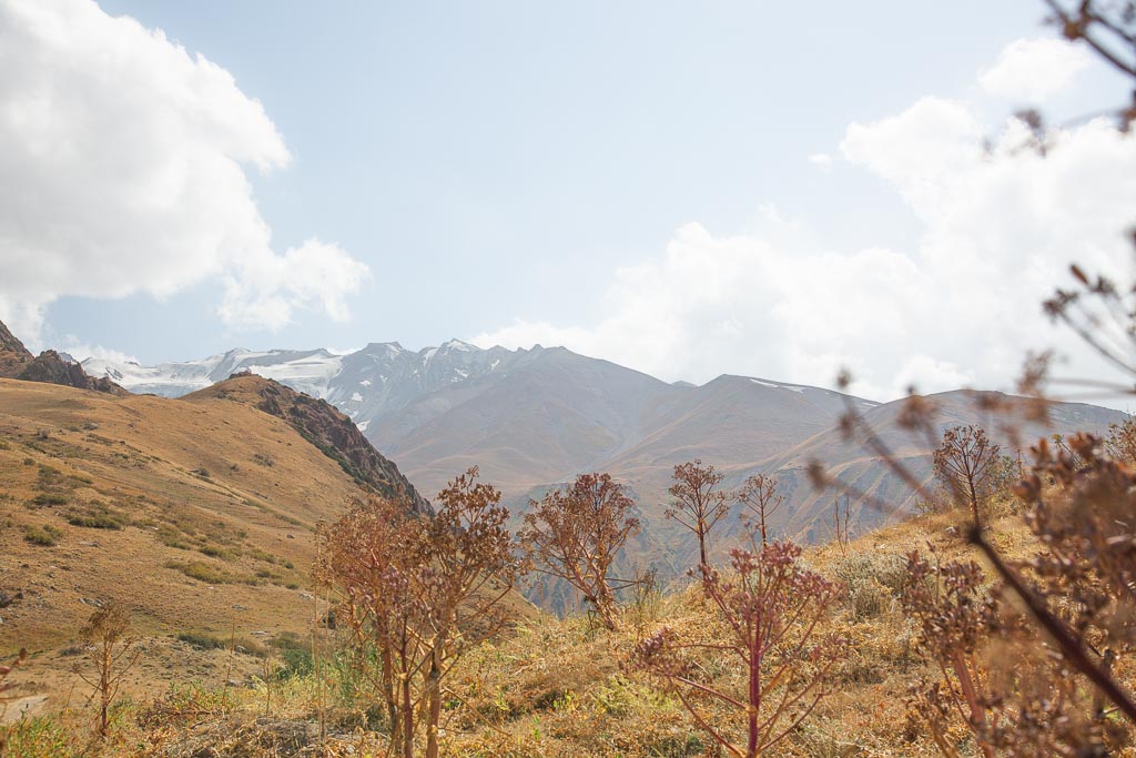
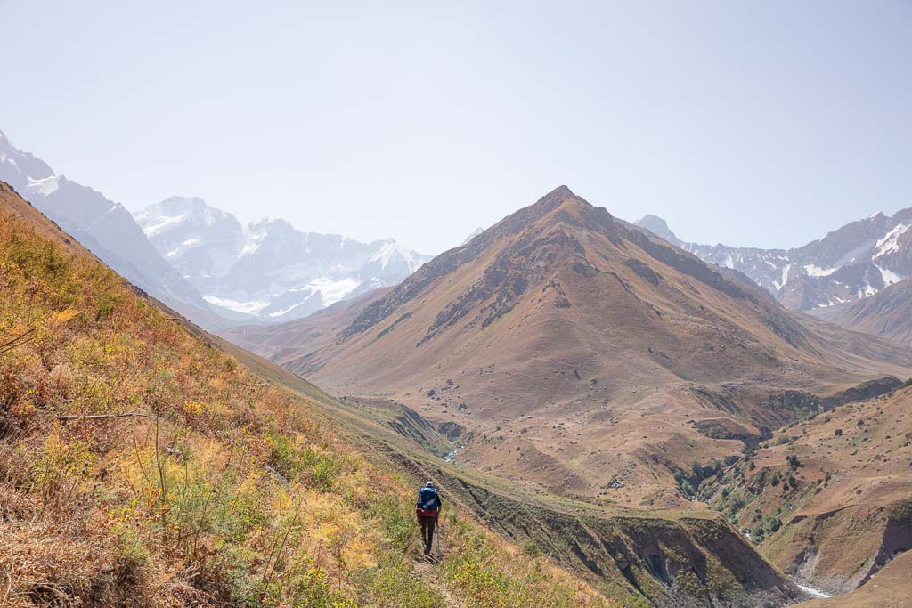
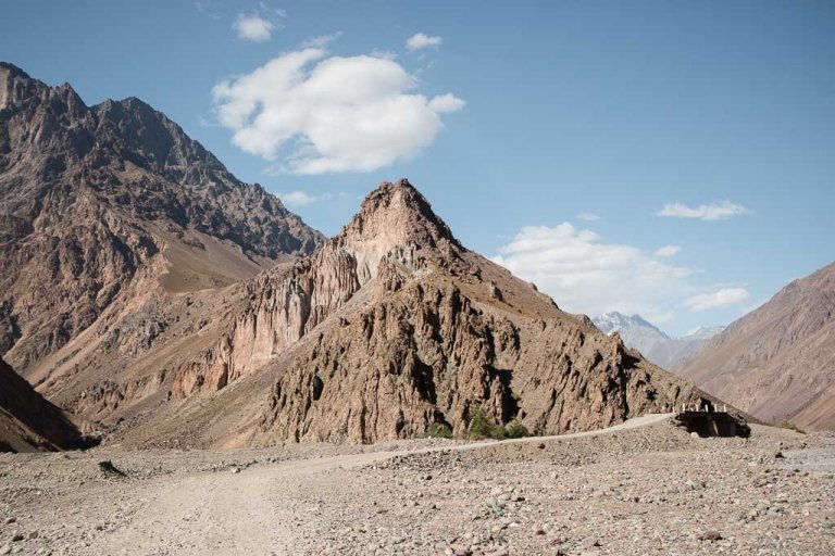
After saying our goodbyes, we continued along the Karashura Plain, following the Karashura River to the southwest. This part of the hike is pretty mellow with stunning views of glacier-covered peaks in the Peter the I Range toward the southeast.
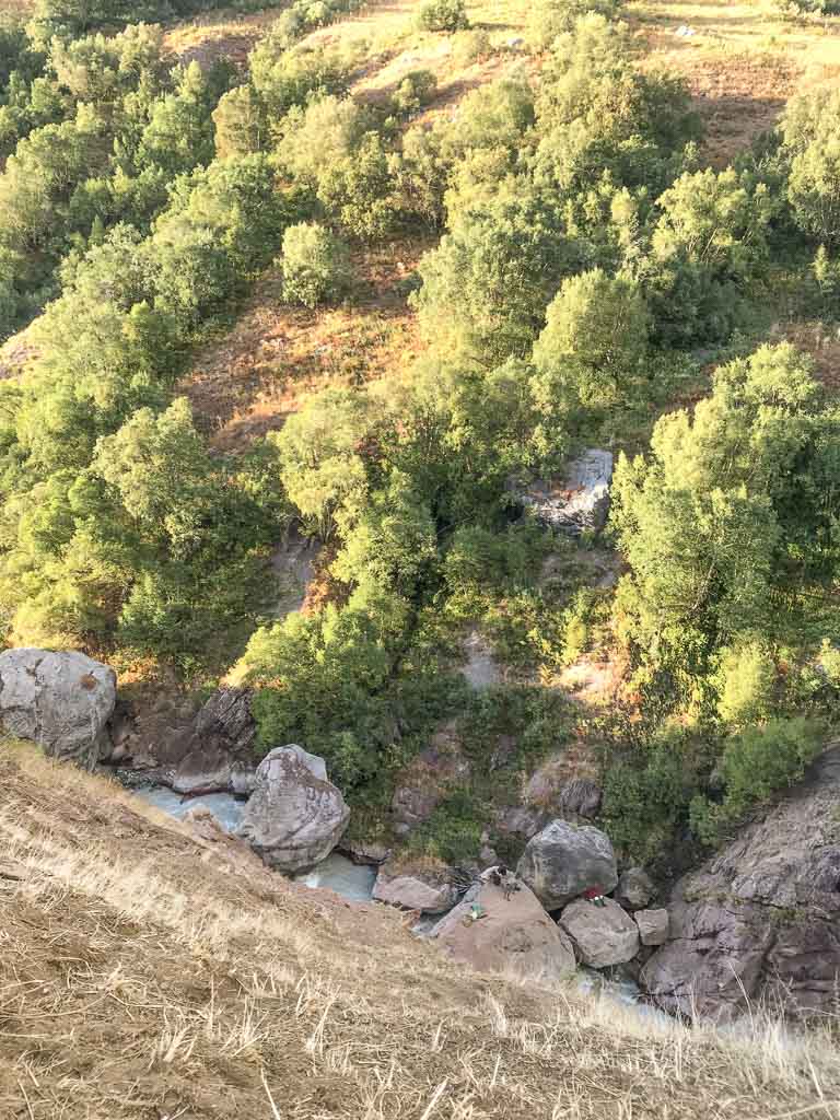
After about seven kilometers you’ll meet the confluence of the Karashura and Vaisirek Rivers. The views at this point are stunning, and you’ll soon cross a bridge to arrive at a shepherd camp.
You can opt to camp here, especially if you started walking from Jelondy. We continued on into the landmined (UXO) area and camped in a safe spot there.
Looking for more trekking ideas? Check out my guide to the Fann Mountains
Section 2: UXO Area To The Gding Plateau
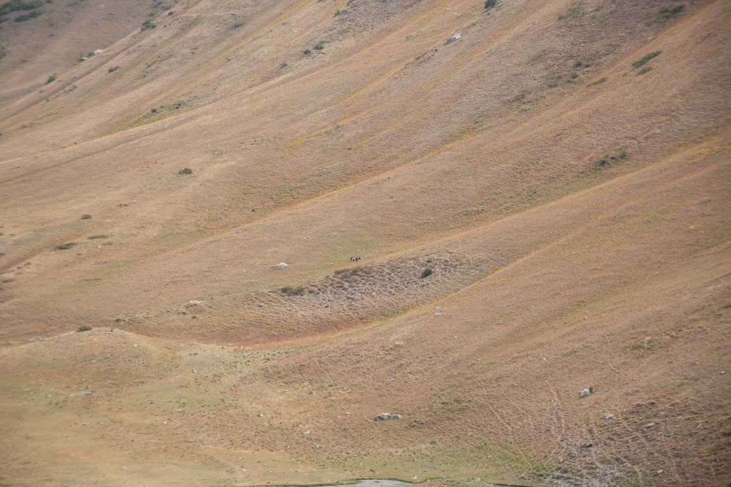
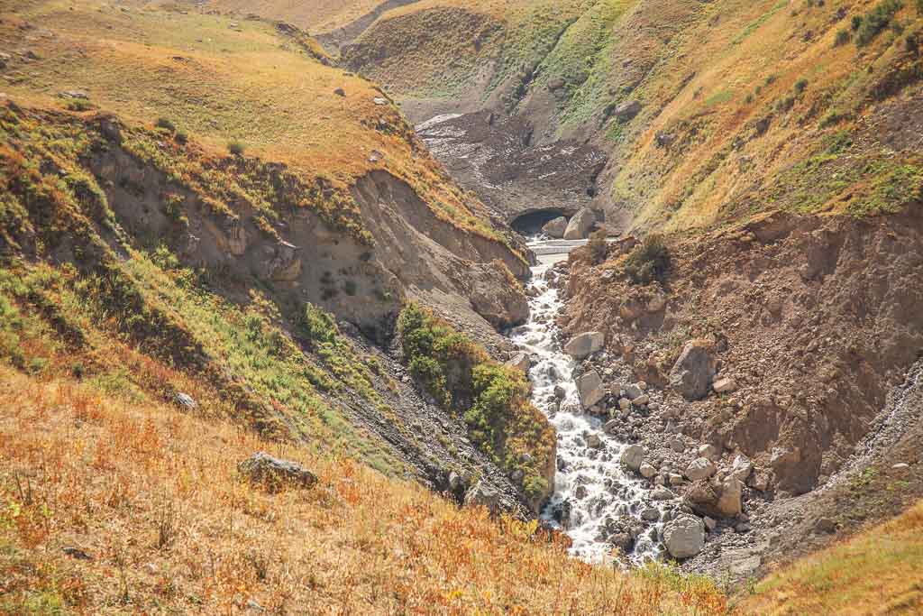
Just beyond the shepherd camp at the confluence that becomes the Obikulika River, you’ll enter the landmine (UXO) area. This stretch of the trek is fairly flat and takes place along an old roadbed.
For the first three kilometers, you’ll pass several shepherd’s tents. If anyone is around when you pass, don’t be surprised if they invite you over for a cup of chai. One of the first ones we passed, a man popped out and invited us over.
We made our way off of the roadbed toward him, assured that this area must have been safe enough to veer off path given the location of his camp, and the giant piles of yak and cow dung everywhere.
We sat down and chatted with him for a short while, him asking Grant where we were going, where we had walked from, where we were from, etc. and I translated between the two (Grant only knows English and can order a drink in Spanish and that’s it, and my Tajik and Russian are limited, but enough to get the gist of most basic conversations a tourist may have).
He invited us to camp by him, but we politely declined because we wanted to trek a bit further that first day. We soon said our goodbyes, the man wishing us good luck before we continued on.
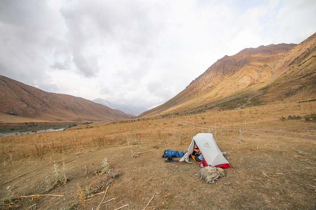
We trekked a couple more kilometers further, setting up camp a short distance off-trail in a stretch of the valley with beautiful views all around.
Camping In A Field Of Landmines
As the sun began to make its way toward the horizon in the later afternoon we set up our tent in a pretty steady wind laughing about how much a pain in the ass it was (spoiler alert: it wasn’t gauging by the shitshow to ensue after this).
We cooked dinner in the dark under the starry sky as gale-force winds picked up in the valley, forcing us to shelter the camp stove to keep the fire from blowing out. We went to sleep afterward with the winds ravaging the sides of the tent all night, it felt like it was coming from every direction.
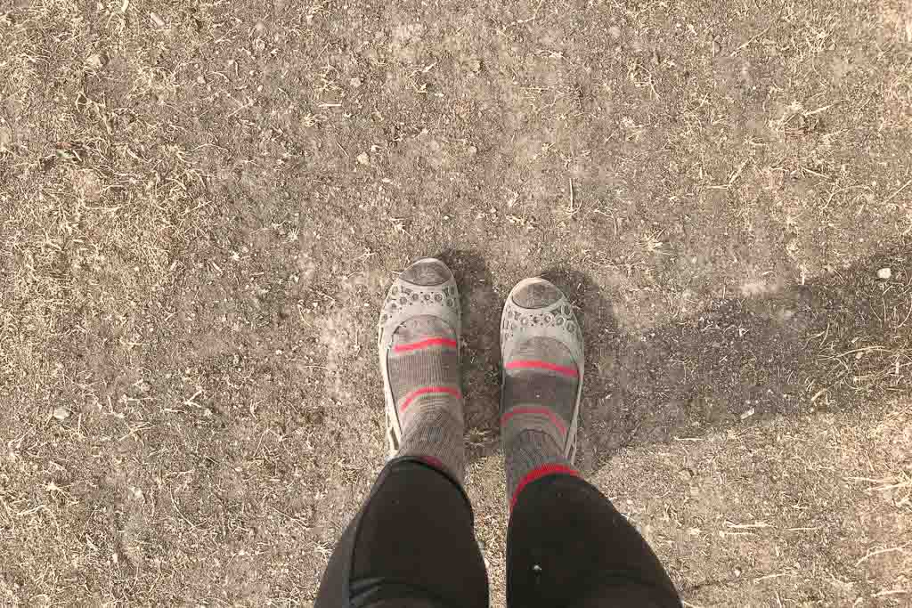
The Great Boot Heist Of 2019
The next morning we woke up to no more wind just after sunrise. I got up and started boiling water for coffee in the tent entry. As I sat there drinking my coffee I noticed my boots weren’t in the entry of the tent.
Grant finally woke up and I asked him he moved them. He said no. I searched all around. They were long gone.
Grant’s boots still were sitting in the entry of the tent, untouched. Periodically in the night between wind gusts, I did hear herds walking by, so the only thing I can possibly think of that could have happened was someone reached under the tent entryway and stole them.
The biggest problem here was that- nobody carries two sets of hiking boots (hello, weight). The only other shoes that I had in my pack were a pair of crocs- not suitable for the terrain to come.
I popped them on over my wool socks (sexy, I know) and wandered off to fill up our water and go for a walk to try and figure out what we were going to do.
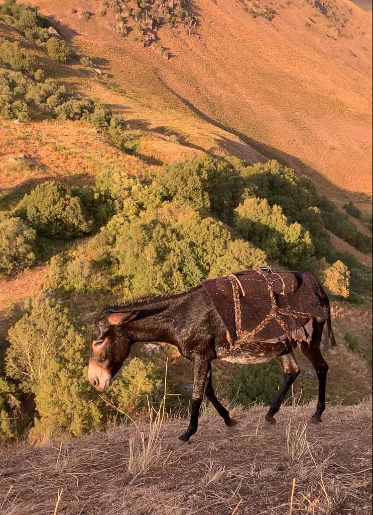
I ran across a man on a white donkey who could clearly tell I was pissed off. He asked what was wrong and I explained my dilemma as he looked at me with such disappointment that someone would do this.
He asked if I was with anyone and I pointed back toward my tent and explained that my husband was there. He told me he would go talk to him and I warned him that Grant spoke no common language, but he went anyways (I was laughing to myself as I knew this would be a hilarious interaction, knowing Grant and a Tajik shepherd).
I continued on past a camp with a couple of men boiling water for chai who invited me over. Again explaining the situation, to which one of the men ripped off his shepherding boots and offered them to me, appalled at my story.
I politely declined his kind offer. How could I take a man’s boots who lives out here and probably won’t come out of the mountains until winter sets in? I thanked him for his kindness and continued on.
Alpine Sexy Time (The Unwanted Kind)
Next, I crossed paths with the man that we had talked to the previous day. Right away, noticing that I was essentially wearing sandals stuffed with my wool sock-clad feet and asked what happened. I told him about the grand boot heist as he pulled out the ubiquitous piece of fabric of Central Asia with meat and naan rolled up in it and offered me food.
I thanked him and said that I had to return to camp. A few moments later he pushed me down, climbing on top of me trying to pin me down. I managed to wrestle him away kicking and hitting a few times on my exit.
I don’t know if it was the combination of the crocs and socks, my mid-thigh length kurta, or my amorphous winter jacket with the hood pulled that sent the message that I must be looking for sex (that’s sarcasm, I wasn’t) and not my shoes, but this was the first time I’ve had to escape a potential rapist in the mountains in all the thousands of kilometers I’ve trekked in the mountains of Tajikistan completely alone. The irony this time is that I wasn’t alone, I was with Grant, who he had met yesterday.
Meanwhile back at camp a man on a miniature white steed, toes dragging in the dirt, pulled up and hopped off, introducing himself to Grant. To Grant’s confusion, he couldn’t decipher anything that was going on as the man surely explained that he had met me and came over to check on him.
He rolled out a cloth and force-fed non and chai to Grant (Grant hates tea and coffee, so I’m a little sad I missed this interaction) before he continued on westward with his herd.
Check out my guide to solo female travel in Tajikistan
And Off We Go
I arrived back to camp to Grant saying ‘oh, thank god you weren’t kidnapped!’ while laughing and going on to tell me about his encounter with the man on the white donkey. He asked me what I wanted to do and I said to continue on because we were 25 kilometers out of 60 in, so what difference did it make (me, consciously ignoring the fact that the more difficult sections were to come regardless of the distance involved).
We broke down camp and packed up. Grant pulled out a pair of worn-out tennis shoes he packed with him to wear around camp in the evening and had me put them on (think no tread left, 10 sizes too big). Though not ideal it was better than a pair of crocs.
We continued back on the roadbed that paralleled the Obikulika River, eventually arriving to a shepherding camp site where we crossed a bridge over the Obikulika to begin our ascent up to the Tupchak Plateau.
Following the trail past the bridge, we continued parallel to the river up past a shepherd camp, a pond, and beyond into an area further down than we should have gone at the base of the plateau.
Later on, we figured out that we should have continued straight, due south past the camp and up onto the edge of the plateau, which would have been much easier than what he did.
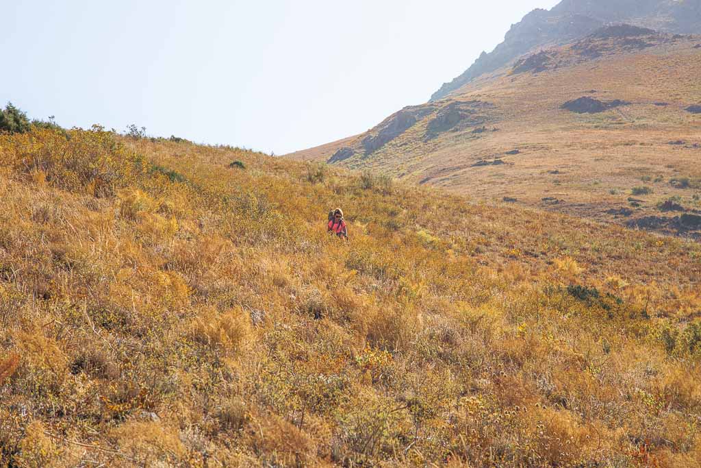
We noticed men up at the plateau’s edge and saw animals trailing behind them where we should have climbed up. So we instead took our own route straight up the side of the 400-meter-up plateau as we were out of Landmine-i-stan now, after all. Slowly but surely we crested over the top onto the plateau.
Exploring the Central Pamir? Don’t miss the gorgeous Bartang Valley and overnight trek to Jizeu
Section 3: The End Of UXO Area To The Gding Plateau
Tupchak Plateau
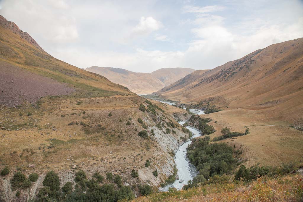
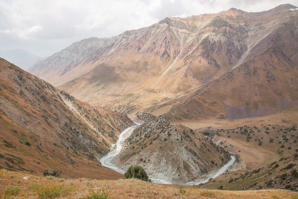
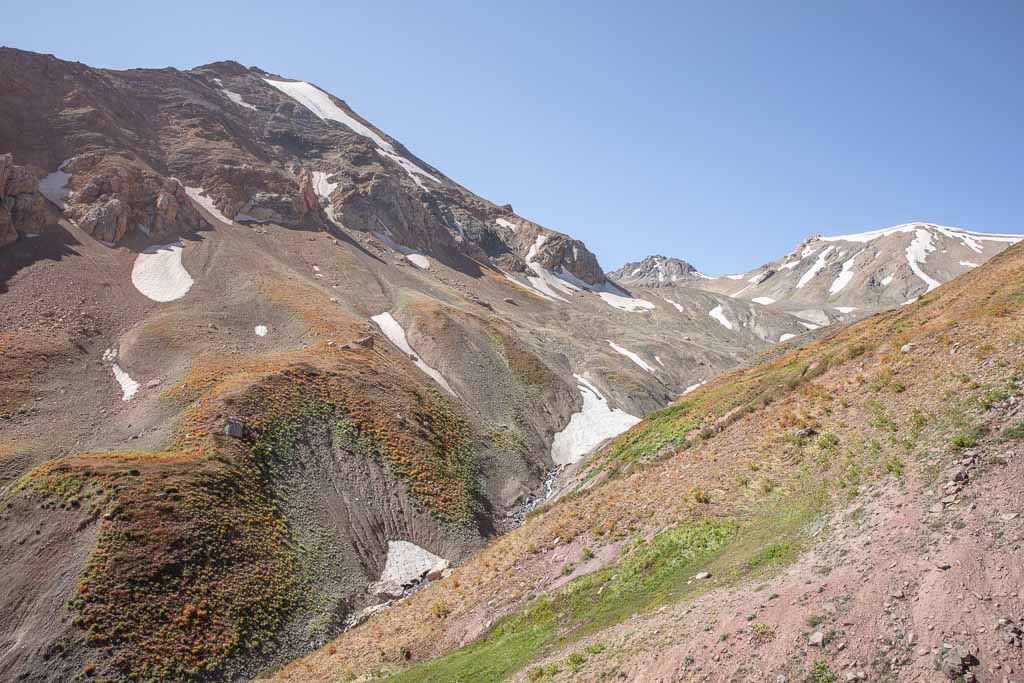
The Tupchak Plateau separates two river valleys, the Obikulika and the Ziuruzamin River, with a couple of shallow rolling valleys within its bounds home to at the time, two dried-up streams. We made our way straight south across the Tupchak Plateau resting at a couple of boulders we passed along the way. Eventually, we could see the crevasse the Ziuruzamin River hurdles down.
The trail notes I had on the Gardan i Kaftar hike showed a permanent snow bridge crossing the Ziuruzamin River, which was nowhere to be found. I’m not sure when, but it has collapsed and it is no more (subsequently making the reactions of any shepherds we met along the trek thus far to our plan to go to Langar make complete sense).
We located a path descending down into the valley and began following it. We passed a young Kyrgyz man (probably in his mid-teens) who was headed the opposite direction with his sheep.
We asked if we were going the right way and he nodded, pointing his stick downriver. The path continued through dense and lush green vegetation (considering it was mid-September in Tajikistan), giving us glimpses of what splendor there is here on the Gardan i Kaftar hike if done in early summer as recommended.
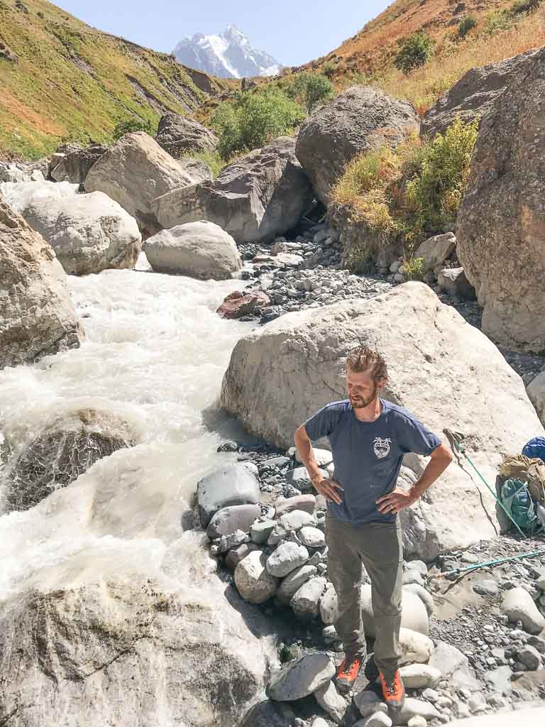
Crossing The Ziuriuzamin River
Full disclaimer: this was the sketchiest part of the Gardan i Kaftar trek. Had I been alone and not crossed paths with anyone going over the river, I likely wouldn’t have been physically able to do this (I had considered doing this hike solo before or after Grant’s visit to Tajikistan, he was only there two weeks).
We walked along raised ground above the eroded northern shore of the Ziuriuzamin River, noticing two men, a donkey, and a few sheep descending carefully down the dusty and extremely steep southern edge of the valley.
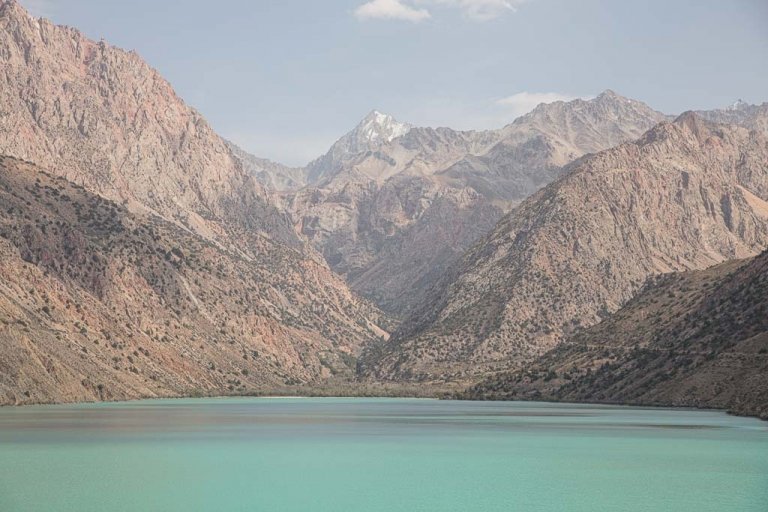
The Ziuriuzamin River is deep and narrow with a fast flow hurdling to the east, so needless to say, intimidating. We spotted the boulder jam ahead perched precariously high over the river where we’d be crossing just a little further down.
Thankfully, we arrived at the boulders as the men from the other side did. Grant was able to barely pull himself up from the first boulder to the second boulder that crested above his head (Grant is 6 feet tall for reference), while I waited below with Grant’s backpack.
I handed it up to him as the shepherd got onto the same boulder as Grant helping grab his bag and sling it to the other side. Needless to say, my turn was next and I was mildly terrified.
The boulder jam wasn’t smooth sailing, the angle the first and second boulder met meant that if I was off-balance coming up, that I’d likely plunge into the river raging below us.
I could almost reach my fingertips to the top of the second boulder (I’m not very tall). After a couple of moments trying to mentally talk myself into it, I finally grabbed hands as Grant and the two men hoisted me up onto the second boulder, backpack strapped to me and all.
I thanked the men and he hopped across the remaining boulders to the other side while one man stayed on the boulder and the other hopped down onto the side we came from while the one on the boulder tossed a couple of baby goats down to the other one (fun fact: baby goats being launched through the air as if they had been launched from a trebuchet sound about the same as a screaming baby).
We began climbing the near-vertical south-facing side of the gorge comprised of loose dust at that point. You could tell this area was badly eroded over the years.
Getting up was quite a challenge without proper boots where I could even get a grip with my feet that kept sliding out. Plus, this is a spot where one wrong move and your hurdling a long distance into the bottom of the valley (ie: bounders and a fast-moving river below).
We eventually made it to a flat enough patch where we could break before continuing up. By this point the men below were still jostling animals around, getting them across the river.
We watched a few sheep cross without batting an eye with hooves designed for hopping among rocks, followed by a donkey who didn’t fare so well.
The donkey was hesitant to jump down off the over 6 foot high ledge to the next boulder, even from as far away as we were at this point I could tell he was scared. Rightfully so, because when the donkey finally built up the courage to jump, he missed, plunging down into the raging river.
At this point, I was full-on ugly crying while Grant looked at me like I had absolutely lost my mind (there was no way that poor donkey survived, I thought. Plus, I had a rough day, okay? My boots got stolen, I almost was raped, after years of trying to convince Grant to visit my favorite country he’s now experiencing the worst sides of it, and now I watched a donkey fall to its death).
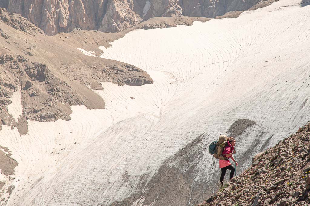
Miraculously, the donkey surfaced downstream and was able to get himself back to the bank on our side. At this point the sun was setting quickly, so we knew we needed to get up onto the Gding Plateau to set up camp for the night. Eventually, we got up the incredibly steep section to a narrow shelf that continued rolling up onto the main Gding Plateau.
At this point that poor soaking wet donkey passed us, ears and head down, dripping water. The look on his face said ‘f*** this I’m going home‘, after all, he did just abandon his people heading in the opposite direction after narrowly escaping death.
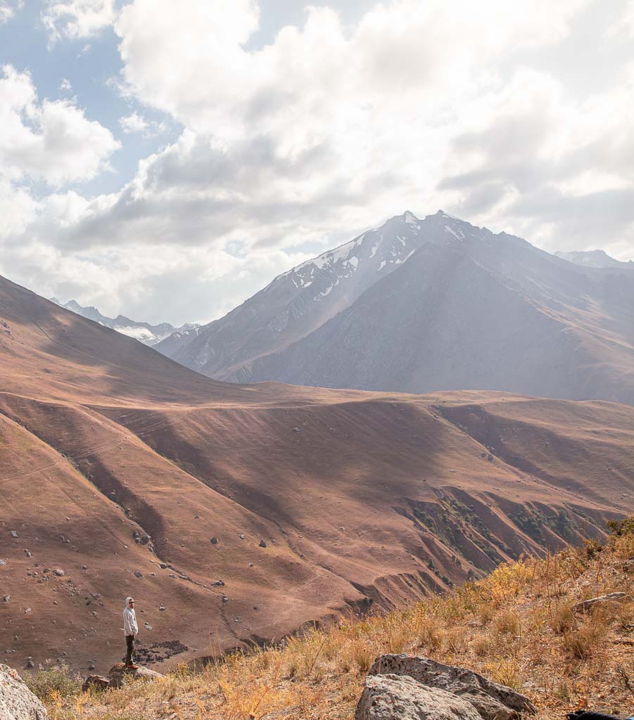
The Gding Plateau
We made the final push up the last 175 meter climb up to the Gding Plateau. The last bit of light had the plateau illuminated as we began to search for a spot to camp.
Both of us had hit that point in the bottom of our reservoirs where you start getting a lot of bubbles in each mouthful you suck through the tube and knew we were running low on water, so we were frantically searching for a spring.
Unfortunately, before we crossed the river with all the chaos that ensued we didn’t fill up on water from one of the stagnant ponds we passed in the gorge.
In the end, we never found water that night even after we settled in and set up camp. It was fine, as we had both drank over three liters of later that day- we just didn’t have the luxury of a warm dinner that night with no water to boil, so dry ramen and candy bars it was.
Planning to head to the Wakhan? Reach my Tajik Wakhan Valley Travel Guide
Section 4: Gding Plateau To The Foot Of Gardan i Kaftar Pass
The next morning we woke up thinking we’d made it to Langar by the end of the day (we were wrong), and ate candy bars for breakfast before packing up and continuing on.
We walked across the plateau that wrapped around a mountain to the south, it was very clear that the Gding Plateau has abundant water in the spring and early summer based on the topography and dry streambeds we passed.
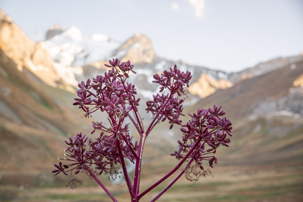
We rounded past the mountain going past the skeletons of wildflowers that paired with the streambeds made me realize just how too late to this hike we were.
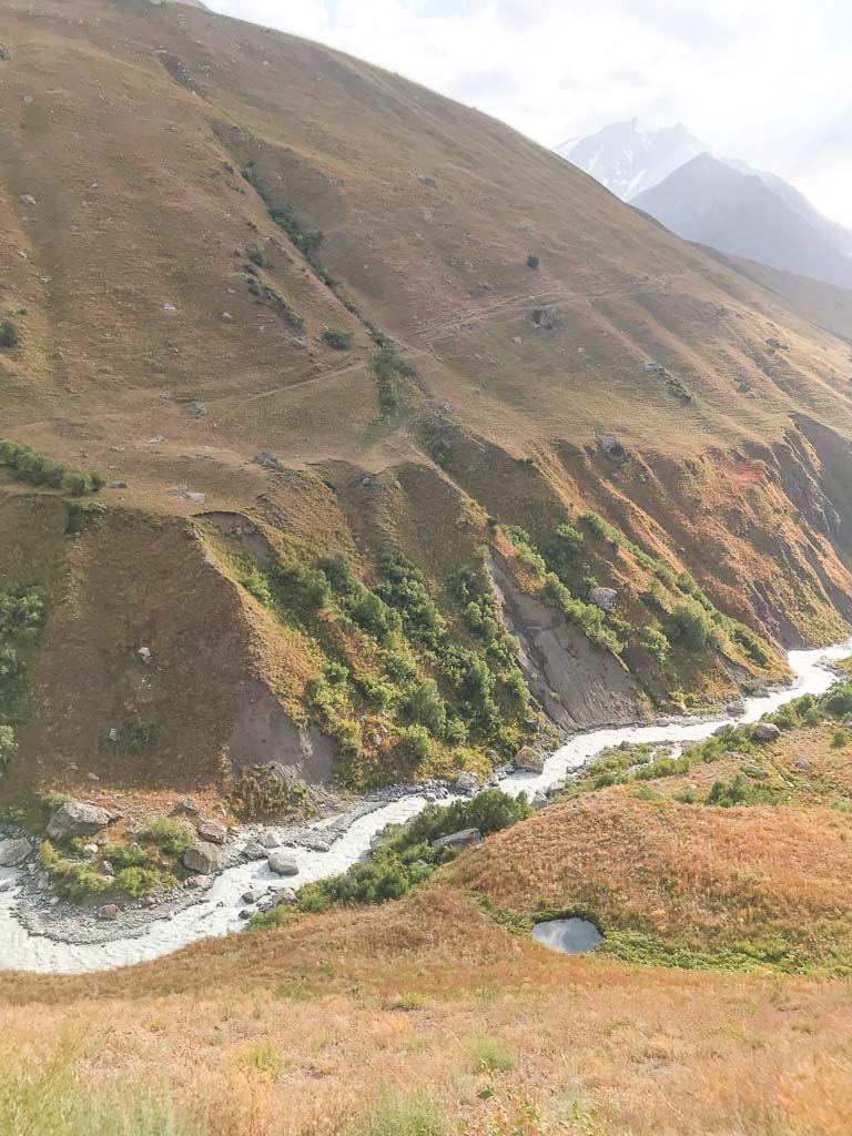
Pulisangin Valley
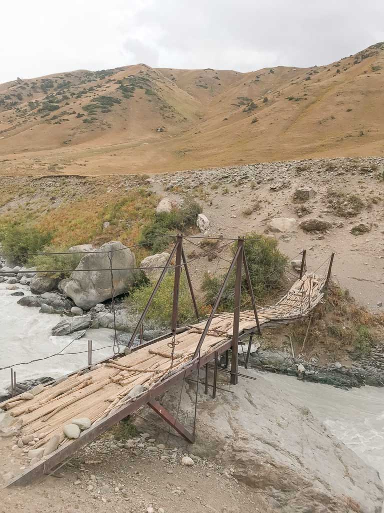
We began the descent down into the Pulisangin Valley as we rounded past the mountain on the plateau. On the way down we noticed a snow bridge across the Pulisagin River, albeit before the one on our map so we pushed further.
Though still intact, in all honesty, it wasn’t looking all too stable. Both being from Alaska and growing up around ice bridges and glaciers this one looked sketchy, to say the least.
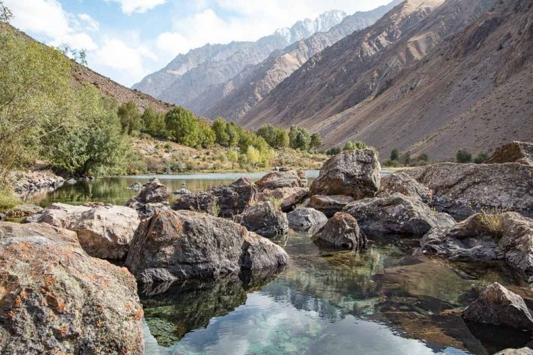
Eventually, we passed the site of a summer pasture camp along the river a couple of hundred meters further once we were down at the riverside (no shepherds were at the camp as they all must have been out grazing animals).
According to my notes, shortly after this, we were supposed to find a natural bridge crossing the Pulisagin River, which we never did find. We decided to break here and finally fill up on water before crossing.
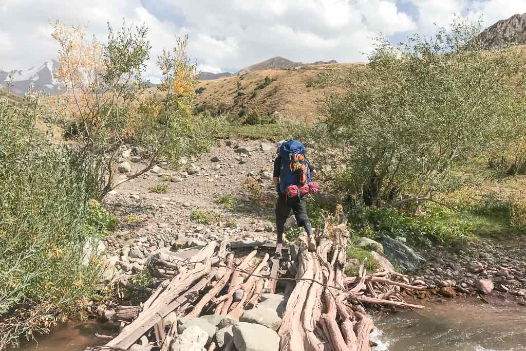
There were areas of large boulders in the river, so we located a crossing that looked possible. Grant had to leap across the largest gap first and then have me throw our backpacks across to him, followed by me jumping.
From here we crossed the wedge of land between the Pulisangin River and its tributary river. The river was running pretty fast on the other side, so we decided to look for the snow bridge mentioned in the notes, or wade the river up higher.
After continuing upriver, we came upon a shepherding camp here where two men invited us in, pouring us cups of chai.
They insisted on feeding us a lunch of mutton, potato, yogurt, and naan. We spent a little while chatting and eating with the men before departing and gifting the men some somoni as a thank you for their hospitality.
From here we went a little further upriver and eventually settled on a spot to cross. It still was a difficult crossing for me as the water was nearly waist-deep. I used both my trekking poles to help me stay balanced getting across this one. It was late afternoon at this point and we wanted to make it toward the foot of Gardan i Kaftar Pass to set up camp.

Spotting A Eurasian Brown Bear
After crossing the river we moved upwards following a maze of goat trails away from the river, knowing we’d soon be crossing a side stream that feeds into the river below.
We reached the tumbling stream as the sky turned pale orange, the water tinged a reddish color from sediments in the rock. As we cross, Grant spotted a bear upstream. I had told Grant prior to him coming to Tajikistan that yes there are bears, wolves, and Marco Polo sheep, but it was highly unlikely he’d run into a bear or wolf… and there we were looking uphill at a burly Eurasian brown bear crossing the stream and heading the opposite direction from us.
Further upstream we noticed a dead bear in the water. At that point we quickly beelined toward camp, continuing south toward the next stream that would indicate we were at the bottom of Gardan i Kaftar Pass.
Camping In Bear Country
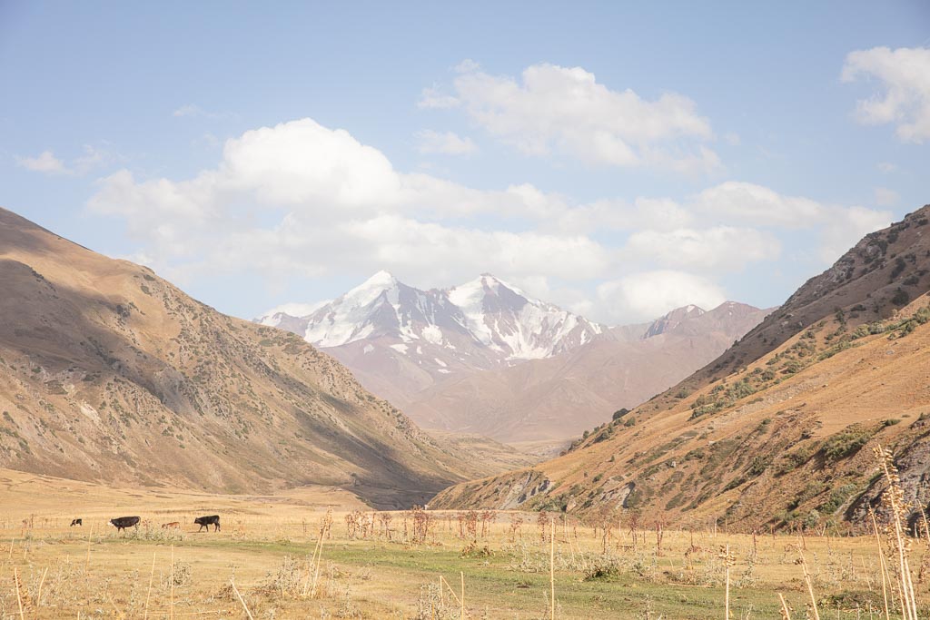
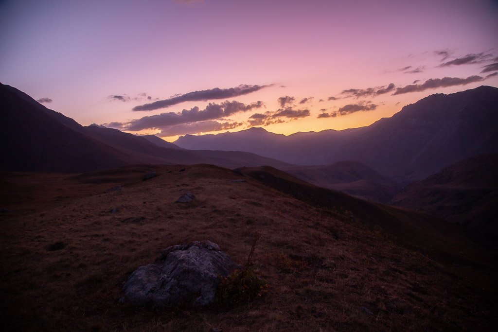
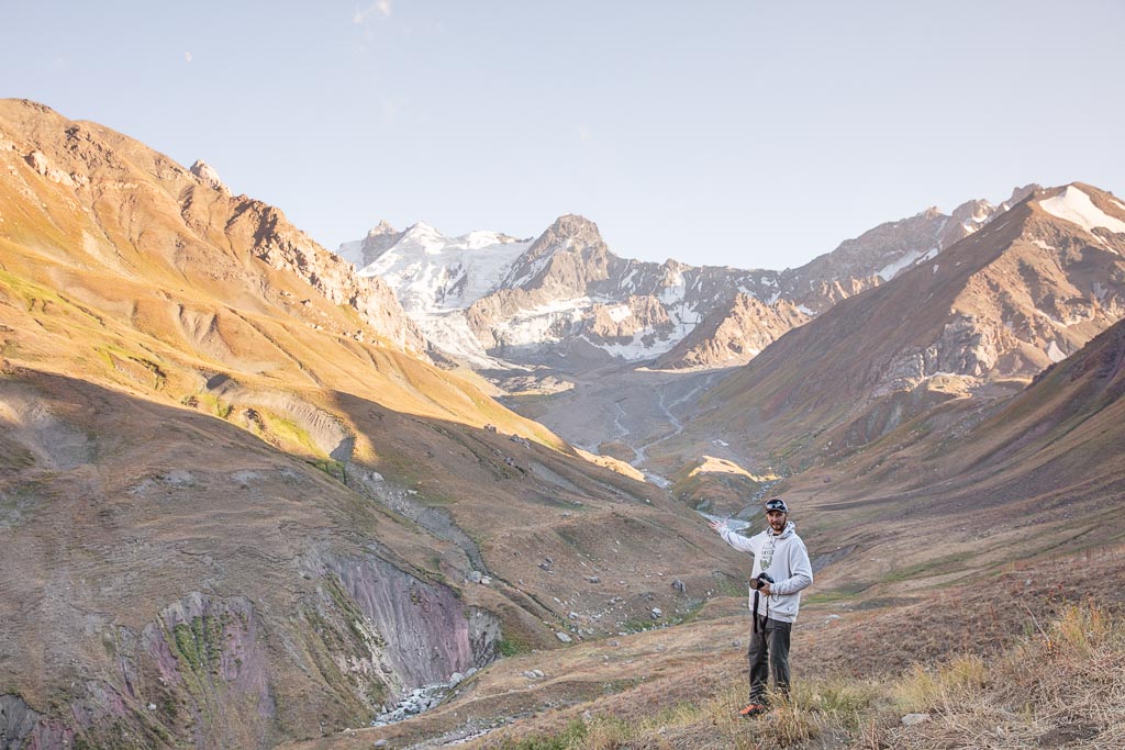
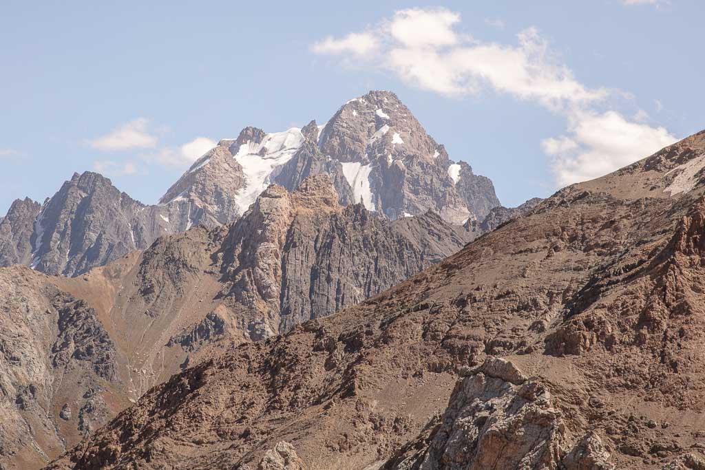
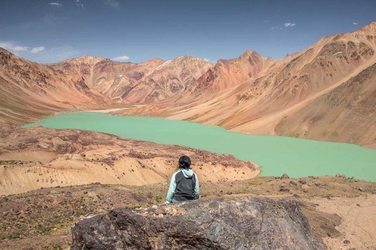
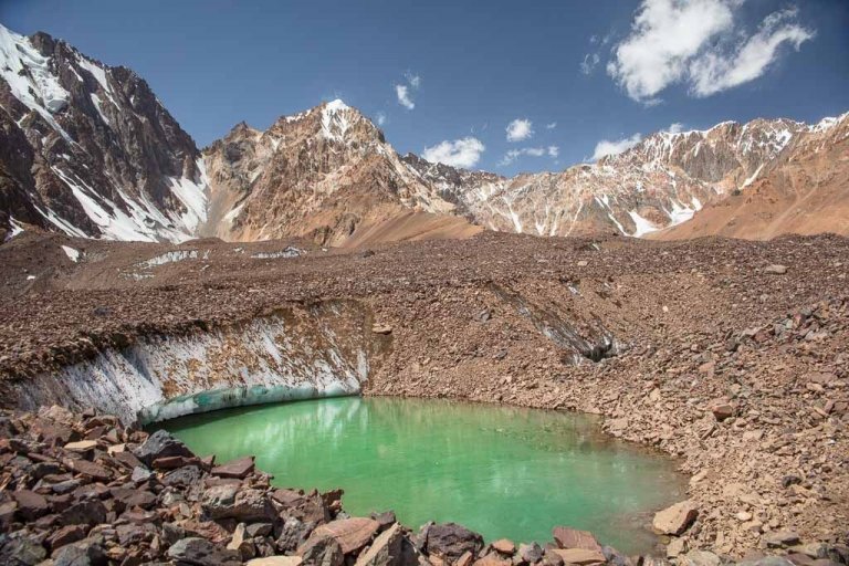
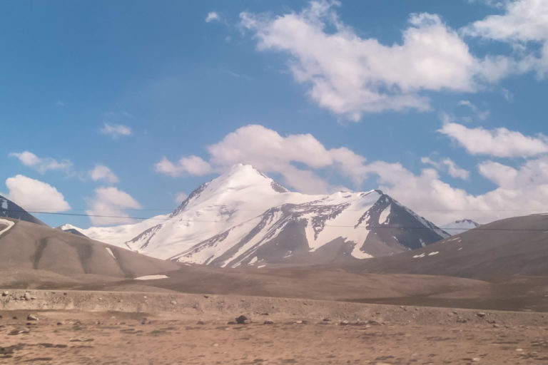
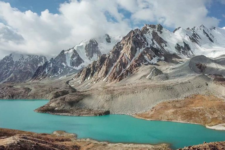
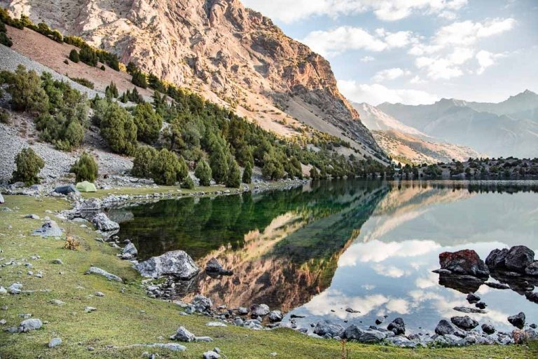
We finally set up camp as blue hour set in, in a flat spot in the foot of the pass set in a valley surrounded by the skeletons of wildflowers once-thriving earlier in the year, with epic views of an unnamed (as far as I’m aware) icy peak to the south (my map just indicated it by labeling it 5,223 meters).
We cooked dinner downwind from our camp and stored our food under a rock there to avoid any run-ins with bears that night. I’ve lived my entire life with bears around in Alaska, so it wasn’t as unnerving as it would be for most other people out here, but camping after just spotting a bear and not being armed with your normal arsenal, like bear spray, is a little uncomfortable.
Heading out into the wilds of the East Pamir? Check out my Eastern Pamir Travel Guide
Section 5: The Foot Of Gardan i Kaftar Pass To Langar
Today was the day! We were hellbent that we were going to make it to Langar. We got an earlier start and cooked breakfast before packing up camp and heading out.
Crossing Gardan i Kaftar Pass
Crossing Gardan i Kaftar was actually one of the easier parts of this trek. The pass is pretty straightforward with the stream staying to your left in a gorge as you zigzag up. It’s hard not to take too long getting up this side since the views are stunning behind you.
We kept a pretty steady pace and broke for an early lunch at a spot where the climb up to the pass leveled off a bit.
Eventually, the terrain becomes less grassy and rockier with giant green onions dotting the landscape. At first, I was in denial that they were green onion until Grant kept insisting they had to be so I broke a strand off- sure enough, after smelling and then tasting, it was definitely green onion.
This naturally tacked on time because I didn’t have a return ticket booked home yet and still with nearly three weeks left on my visa these were precious herbs to be added to future meals. In general, Tajik cuisine is quite bland and muttony (unless it kurutob which is usually excellent), so I had to collect some to take on.
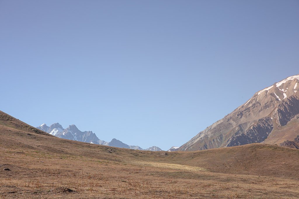
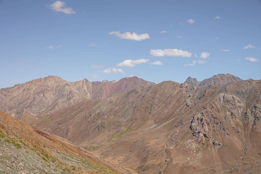
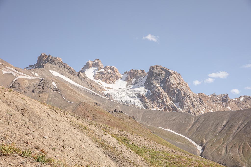
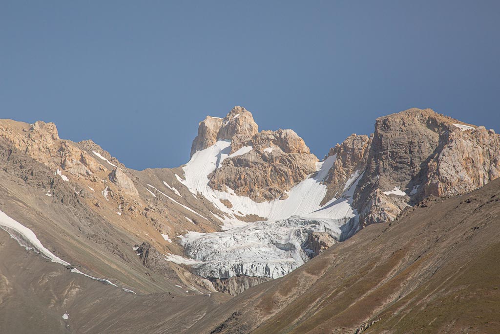
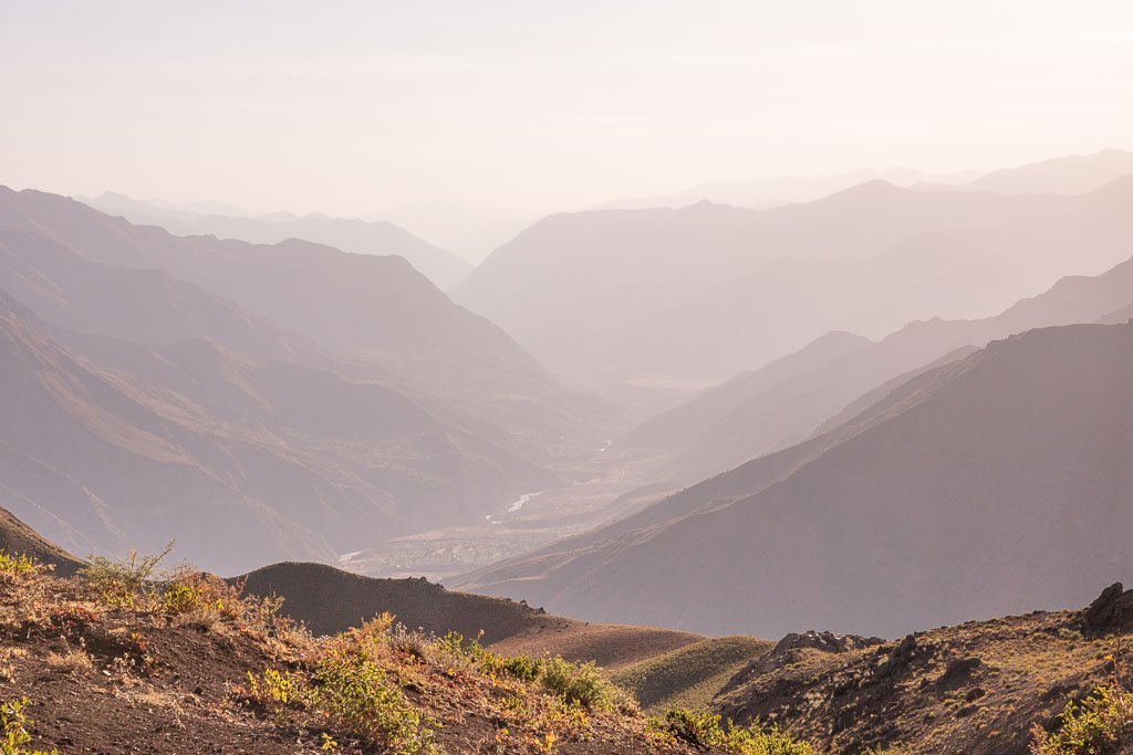
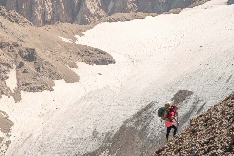
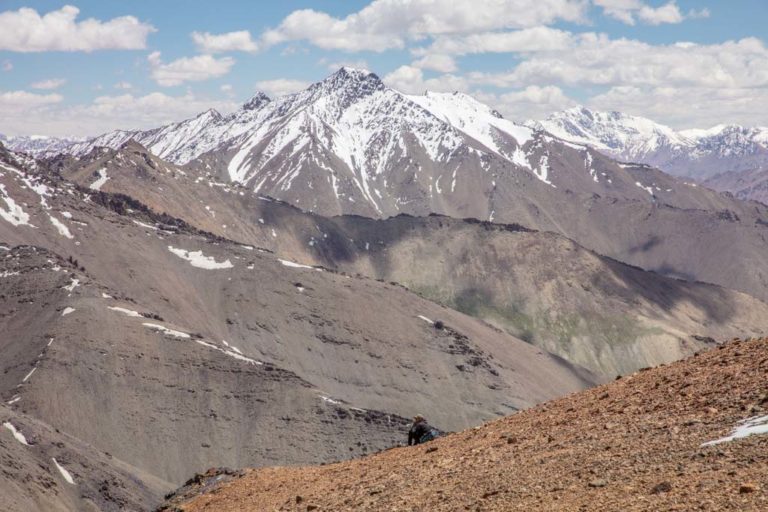
The last section heading up to the pass is really rocky with you having to cross a couple of large lumps that looked like glacial moraines. The trail then makes a slight bend to the west as you pass a glacier on your left before making the final approach to the pass. From the pass at 3,745 meters, we had excellent views of the Peter the I Range as it gnarls around from Gardan i Kaftar, and down onto the rolling plateau ahead of us.
The descent down the pass was quick and straightforward. Once down to the bottom we broke for quick snacks before continuing. The path is obvious from the top of the pass, down it, and across the plateau.
As we neared the sidestreams that branch off the Langar River toward the start of the climb up to the next pass (unnamed) the landscape almost changed seasons in an instant, from crunchy dead fall vegetation to lush greens.
We crossed several little streams, most navigable by hopping between rocks strewn through the water. After passing the Langar River we reached the start of the climb up the unnamed pass.
We met a shepherd from Langar just near the start of the pass who invited us to camp with him (looking back I wish we should have as Langar was a bit further away still than I completely realized.
We thanked the man after sharing some chai and chatting with him and continued on our way. The sun was already setting at this point but we were determined to make it.
Crossing The Unnamed Pass
The unnamed pass is quite small in reality with an ascent of 175 meters from where we already were, bringing it to a grand height of 3,190 meters. The reason for climbing the pass is to bypass a section of cliffs on the descent down into Langar.
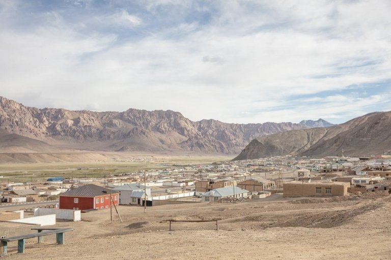
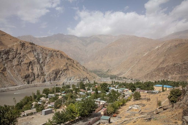
From the top of the unnamed pass, we had perfect sunset views over Langar, the Khingob Valley, and the Darvaza Range further south. The trail continues down along a ridgeline and eventually gets a bit hard to decipher as it’s a maze of goat tracks at this point. The path becomes obvious once again and drops you off by some farmhouses on the outskirts of Langar.
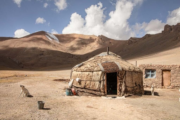
Arriving To Langar
By the time we arrived in Langar proper, it was pitch black. We wandered down a couple of streets not seeing anyone. We finally found a group of four or five young men working on a car on a dead-end alley and asked them if there was a homestay (we knew there was one functioning out of a home here).
The men gave us directions to a home and away we went. We eventually wandered into a yard and met a woman who had to be close to my age and I asked her if this was the homestay. I don’t think she could understand my Tajik with a thick accent so she grabbed me by the arm and jostled me next door, which turned out to be the home we were looking for.
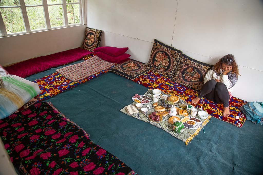
The wife of the home showed us to a room upstairs and quickly brought us plates of naan and candies and a pot of chai. She got her husband on the phone, Munir, who explained he would be home soon to me.
Munir works for the Tajik National Park (he told me Sangvor National Park, but I’m assuming he oversees the Sangvor area of the Tajik National Park), and takes in hikers and travelers who come to this rarely visited area of Tajikistan.
Munir and his wife treated us like family, having dinner with us and staying up late into the night chatting with us until no one could keep their eyes open any longer.
We had decided to arrange a ride to Qalaikhumb the following day via the northern route of the Pamir Highway over Sagirdahst Pass, though it was very tempting to stay in Langar and go explore the Sangvor* area that Munir cheerfully described to us (I’ll be back to see what else is out there one day).
Munir invited his nephew Mohammed to breakfast the next morning, who studied in Dushanbe and spoke English very well (to Grant’s excitement since he doesn’t understand any of the languages spoken in these parts). Mohammed also works in the national park too when he’s on school breaks.
Since we did not purchase Tajik National Park permits, Munir and Mohammed collected our park fee (18 TJS per day) prior to leaving.
If you start or end your trek in Langar and want to contact Munir Chobirov ahead of time, his phone number is +992 93936513.
*The only thing I really know of Sangvor is that that the village served as a hideout for opposition fighters of the United Tajik Opposition during the Tajik Civil War.
GBAO Permits
You need a GBAO permit in order to get from Langar to Qala i Khumb or other destinations in the Pamir.
If you didn’t apply for the GBAO permit on your visa or e-visa, or you came to Tajikistan with a visa on arrival, it’s possible to get a GBAO permit at the OVIR office in Dushanbe (Mirzo Turzunzade Street 5). The turnaround was 20 minutes in September 2021 and cost 20 TJS for the permit.
Getting To Jirgatol
Getting to Jirgatol from Dushanbe is simple. Get a taxi from the city to the Rasht Avtovagzal east of the city. Shared taxis depart to the Rasht Valley when full. Just say you’re going to Jirgatol and you’ll be directed to a car. The ride will cost 80 TJS. From Jirgatol to Dushanbe for those doing the trek in reverse, shared taxis depart the main street in the mornings. Hotel Safariyon or the guesthouse can help you set it up as well.
Getting To Langar
Getting to Langar is a little more difficult as this whole area doesn’t see a lot of traffic. Your best bet is to try and hop in a shared taxi or hire a taxi from Tavildara, the nearest regional center. Ending the trek in Langar you can get a shared taxi from Langar to Tavildara, but it may be a day or so before one leaves.
What To Pack For The Gardan i Kaftar Hike
Here is a general list of gear I recommend bringing and useful maps and books. If you want a definitive list of other items, click here to see a full list I recommended for trekking in the Fann Mountains in northwest Tajikistan.
Gear
- Inreach Explorer+
- Backpack (I personally recommend the Ariel 65 for women)
- Hiking boots (My favorite are the La Sportiva Nucleo High GTX)
- Waterproof sandals
- Katadyn water purifier
- Sleeping mat
- 3-season tent
- Hydration Pack
- Sleeping bag cold rated to -5 C/20 F
- Campstove and Cooking set
- Silicone squeeze tubes (for cooking with sauces, olive oil, etc.)
- Propane/butane canister (available for purchase at Greenhouse Hostel in Dushanbe)
- Trekking poles
- Headlamp
Maps & Books
- ‘The Pamirs Map‘ by Markus Hauser. Can be found online on Amazon, or can always be picked up at the PECTA office in Khorog.
- ‘Trekking in Tajikistan‘ by Jan Bakker and Christin Orhiol. Includes notes on this trek albeit somewhat outdated.
- ‘Bradt Guides Tajikistan‘ by Sophie Ibbotson and Max Lovell-Hoare.The most in-depth and up to date guidebook to Tajikistan in print.
- The ‘Central Asia Phrasebook‘ by Lonely Planet I found to be a handy item for Tajik, Russian and Kyrgyz phrases.
Have Any Questions About The Gardan i Kaftar Trek?
Ask in the comments section below.
More Posts from Tajikistan:

Ishkashim Border Crossing Between Tajikistan & Afghanistan
Khujand Travel Guide + 14 Things to Do In Khujand
The Best Restaurants In Dushanbe
The Ultimate Tajikistan Travel Guide
Trekking The Haft Kul in Tajikistan’s Fann Mountains
Two Week Tajikistan & Uzbekistan Itinerary
Tajikistan Itinerary For 1-4 Weeks
Must-Try Tajik Food: Best Food in Tajikistan
A Guide To Tajikistan’s Fann Mountains
The 10 Best Hikes In Tajikistan
Panjakent Travel Guide + 6 Things To Do In Panjakent, Tajikistan
17 Things To Do In Tajikistan
A Beginner’s Guide To Central Asia Travel: Discover The Silk Road
Panjakent-Samarkand Border Crossing Between Tajikistan & Uzbekistan
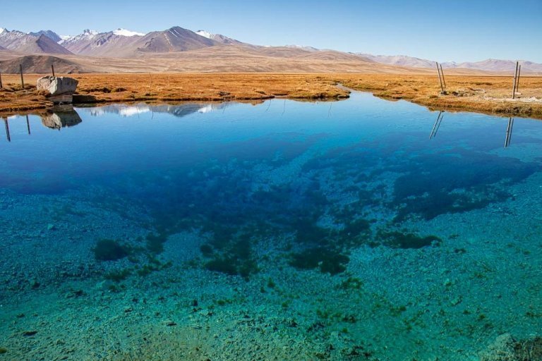
Rasht Valley, Tajikistan
How to Cross the Shirkhan Bandar Border Crossing Between Tajikistan & Afghanistan and get an Afghan Visa on the Border
The Gardan i Kaftar Hike In Tajikistan’s Rasht Valley
A Day Trip To The Taboshar Uranium Mines in Istiklol, Tajikistan
A Day Trip to Madiyan Hot Springs, Tajikistan
Windswept Desolation In Karakul, Tajikistan
Gumbezkul Pass Hike, Tajikistan
Murghab Travel Guide + 4 Things To Do In Murghab, Tajikistan
The Beautiful Bolshoi Allo Lake In Tajikistan’s Fann Mountains
Sarazm Ruins, Tajikistan: The Oldest City in Central Asia
How To Get To Khafrazdara Valley, Tajikistan
Qala i Khumb Travel Guide, Tajikistan
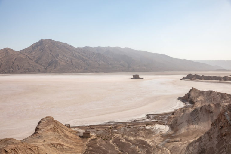
A Giant Salt Flat in Tajikistan? Welcome to Akhkon
Crossing Chimtarga Pass
How To Get To Timur Dara Lake, Tajikistan
A Guide to the Shokhdara Valley, Tajikistan

How To Get To Lake Sarez, Tajikistan
Trekking to Pik Engles Meadow in Tajikistan’s Wakhan Valley
Across Tajikistan In 80 Photos
Climbing Kyzyldong in Tajikistan’s Pamir Mountains
How To Get To Hisor Fort, Tajikistan
Crossing Kyzyl Art Pass Between Tajikistan & Kyrgyzstan
Tajikistan Border Crossings
Khorog Travel Guide + 7 Things To Do In Khorog
25 Day Tajikistan Expedition June 12-July 6, 2024
Is Tajikistan Safe? The Short Answer: Yes
Fann Mountains Trekking Expedition, Tajikistan June 12-23, 2024
Solo Female Travel in Tajikistan
Tajikistan Visa Guide: How to Get a Tajik Visa
Istaravshan Travel Guide + 9 Things To Do In Istaravshan
The Tajik Wakhan Valley Travel Guide
Jizeu Trek: Tajikistan’s Best Overnight Hike In The Pamirs
10 Reasons to Visit The Pamirs

12 Day Pamir Highway Expedition
The Best Road Trips In The World
A Simple Guide To Central Asia Visas
Yagnob Valley Trekking & Travel Guide
Iskanderkul & Sarytag Travel Guide, Tajikistan
Hike The Lakes Loop in Tajikistan’s Fann Mountains
10 Things To Do In Dushanbe + Dushanbe Travel Guide
Crossing The Qolma Pass Between Tajikistan & China
The Ultimate Guide To The Pamir Highway
10 Reasons To Visit Tajikistan
7 Tips For Solo Female Travel In Central Asia
A 10 Day Pamir Highway Itinerary including the Wakhan Valley
Bartang Valley Guide
Crossing Dukdon Pass In Tajikistan’s Fann Mountains
South Aral Peak Hike, Tajikistan
Visiting the Sary Khosar Nature Reserve, Tajikistan

How to Visit Childukhtaron, Tajikistan
Eastern Pamir Travel Guide
10 Off The Beaten Path Destinations For 2021
Travel with Me to China, Tajikistan and Pakistan in 2018!
Loved this story. My favorite part is when the donkey survives and takes off with a “screw you” look on his face. The trip next year is definitely on my list (along with Wakkhan) so I hope it goes! Would it include or be near any part of this trek?
I still think about that donkey a lot. Like where did he go? Did he make it home? I’ll never know…
So the trip next year won’t be near this area of Tajikistan at all, it will be in the far west in the Fann Mountains (we’re specifically thinking a variation of the Lakes Loop), and the Yagnob Valley. The Rasht Valley (where this trek began) and the area around Sangvor where it ended is a place I need to spend a lot more time exploring and learning about, but I think there is some amazing potential to do some pretty wild trips back here. If getting back to Tajikistan this fall becomes a possibility I have a loose plan to string several hikes together that would cross the country from west to east (and therefore give me even more ideas to harass Matt and TK with for future plans!).