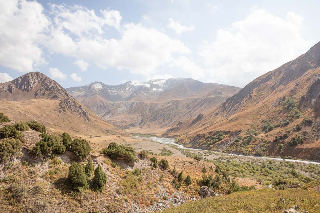
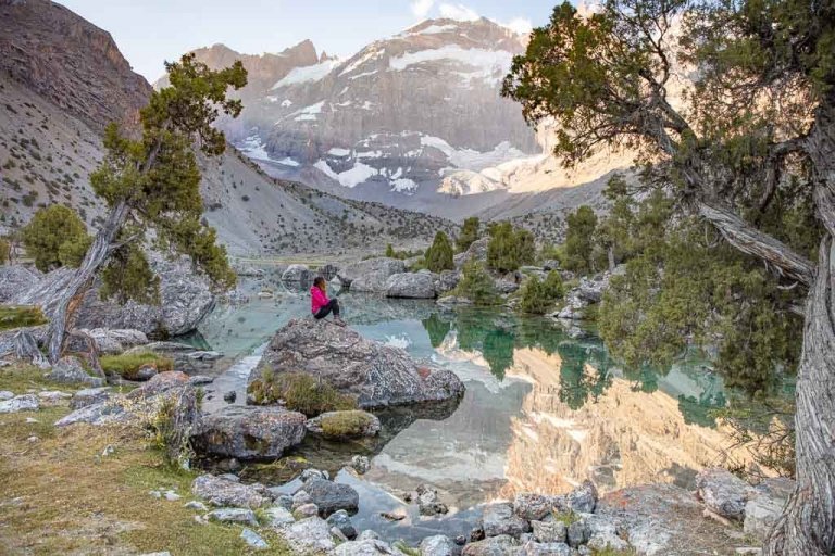
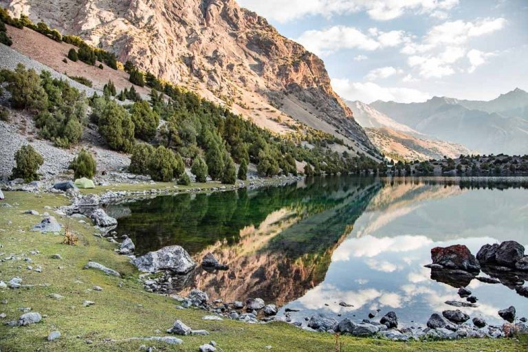
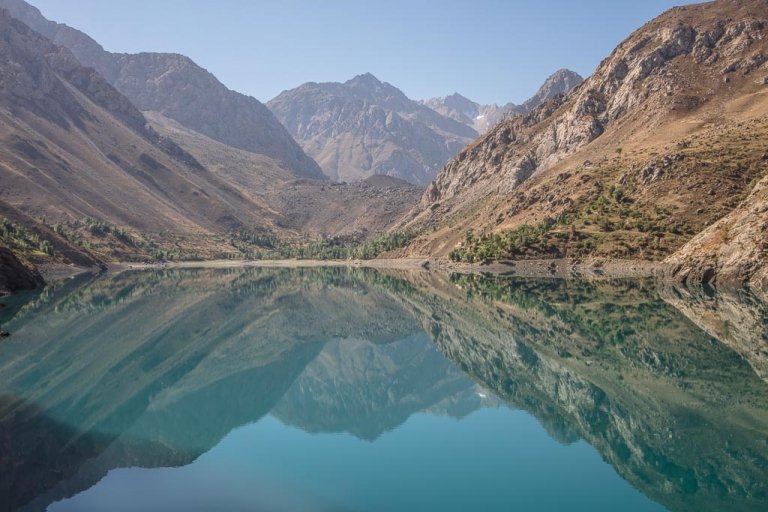
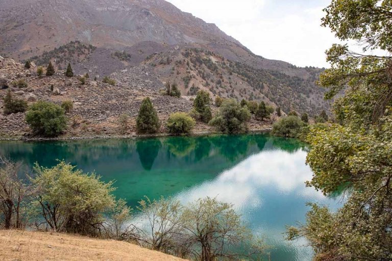
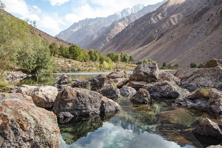
Rasht Valley, Tajikistan
Updated March 2024, Rasht Valley, Tajikistan was originally written in November 2019
It took me five trips to Tajikistan before I finally made it to the Rasht Valley. The little-visited region of the country had been on my radar since 2017.
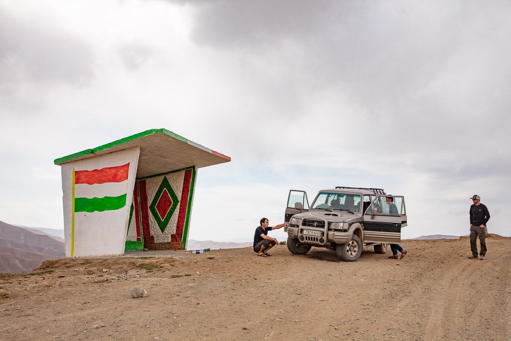
To be fair, the Rasht Valley is a bit inconvenient to visit with the closed to foreigners Tajik-Kyrgyz border at Karamyk, so it’s just not a place you pop in on your way somewhere else. You have to want to go there.
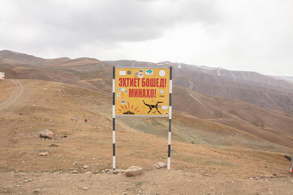
Another factor that scares some off is the fact that the parts of the Rasht Valley still have active landmines as the valley was an opposition stronghold in the 1990s Tajik Civil War.
But the Rasht Valley does offer plenty of reasons for intrepid and prepared travelers to visit. The valley was an important passage, referred to as the Karotegin Route, along the ancient Silk Road, tying Kashgar to northern Afghanistan. This reason is why you’ll also see it referred to as Karotegin Valley.
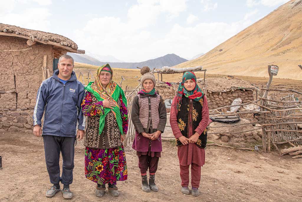
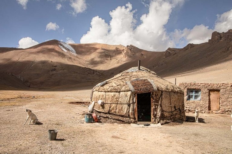
Historically, the valley was populated mostly by Kyrgyz, but in the 1700s a deadly plague greatly reduced the population which allowed for ethnic Tajiks to move in. The mixture of ethnic groups is still very obvious when you visit the area, in fact, I found that many people I met while traveling in the Rasht Valley would tell me about their Kyrgyz mother and Tajik father (or vice-versa), and go on to tell me they spoke Tajik, Kyrgyz, Russian as well as various local dialects.
In the 1990s the valley saw intense fighting during the Civil War, especially around the city of Garm.
Start here: The Tajikistan Travel Guide
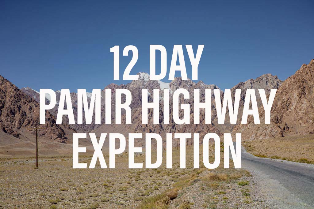
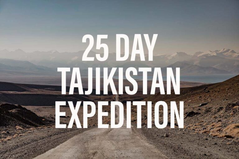
Wanna join a group expedition on the Pamir Highway?
I will be leading a 12 day expedition down the Pamir Highway June 25-July 6, 2024. There is also an option for a 25 day Tajikistan Expedition that also includes a trek in the Fann Mountains.
Need Travel Insurance and Evacuation Services for Tajikistan?
Start shopping for travel insurance plans over at IATI Insurance. Readers of the Adventures of Nicole get a 5% discount off your plan.
The Adventures of Nicole partners with Global Rescue to offer the world’s leading medical evacuation and security advisory services. To travel with peace of mind, shop evacuation coverage at Global Rescue.
How To Get To The Rasht Valley
You can easily reach most towns along the Rasht Valley by shared taxi or hired transport from Dushanbe. Shared taxis typically leave both from Garm Dok at the intersection of Mirzo Riso and Adkhamov Streets and from Rasht Taxi Stand, on the fringe of Dushanbe, about 7 km East of Rudaki Avenue. A taxi from most accommodations in the city will cost 25-30 TJS.
Shared taxis to destinations in the Rasht Valley should fall between 60-100 TJS. I paid 80 TJS for a seat in a shared taxi to Jirgatol.
Starting your Tajikistan adventure from the capital? Read: The Dushanbe Travel Guide
Where To Go
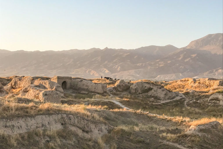
Faizobad
Of the few that make the journey along the Rasht Valley, most just pass through the small town after leaving Dushanbe. The only main attraction here is Sar i Mazar Shrine. In addition, there is the Abu Abdurahman Mausoleum as well as a small historical museum.
Obi Garm
With a name translating out to ‘warm water’, it’s only natural to assume there are a few hot springs in the area.
The main reason to stop into Obi Garm is to visit the Obi Garm Sanatorium, whose water is believed to have the ability to heal many ailments. You can visit for 150 TJS per day.
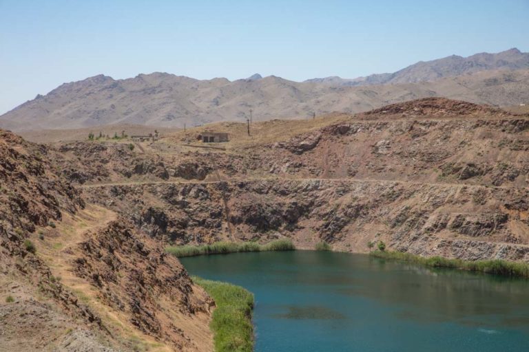
Rogun
Rogun is a town that proliferated when the construction of the tallest dam in the world began, blocking off the Vakhsh River. The dam plan collapsed with the fall of the Soviet Union. A lot of back and forth have gone on since then, but in 2016 construction began once again and the first turbine was commissioned in 2018.
Uzbekistan’s late president has criticized the Rogun Dam because of fears of water diversion to negatively impact Uzbekistan’s cotton crops (Tajikistan and Uzbekistan have 1,001 beefs so this is no surprise on either side).
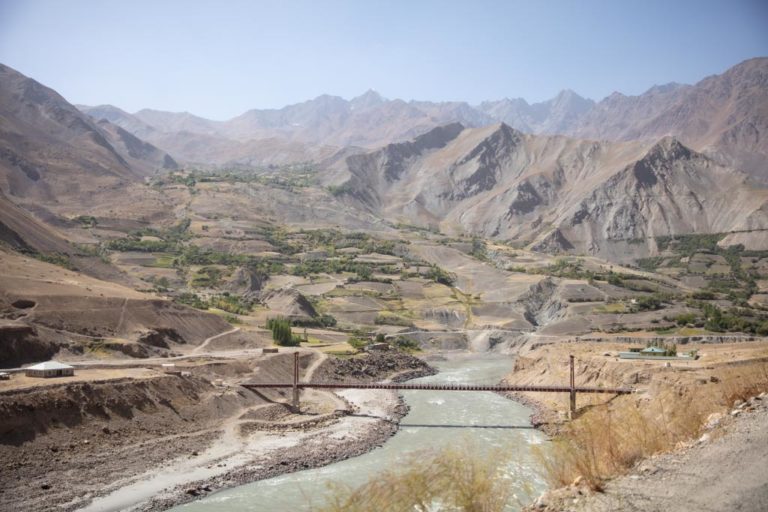
Nurobod (Formerly Darband)
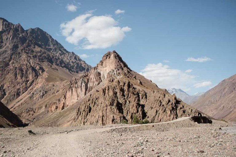
Just past the town of Nurobod the road forks where you can continue north toward the Karamyk border with Kyrgyzstan, or head south along the true Pamir Highway (often called the ‘northern route’) to Tavildara where you’ll head South to continue on the M41 over Sagiridasht Pass to Qala I Khumb.
Continue South Toward Qala i Khumb
Tavildara
Most people only pass through Tavildara en route to Qala i Khumb taking the northern route of the Pamir Highway. There isn’t much to do or see in Tavildara, though a Tajik friend of mine said the sea buckthorn berries here are worth a stop for.
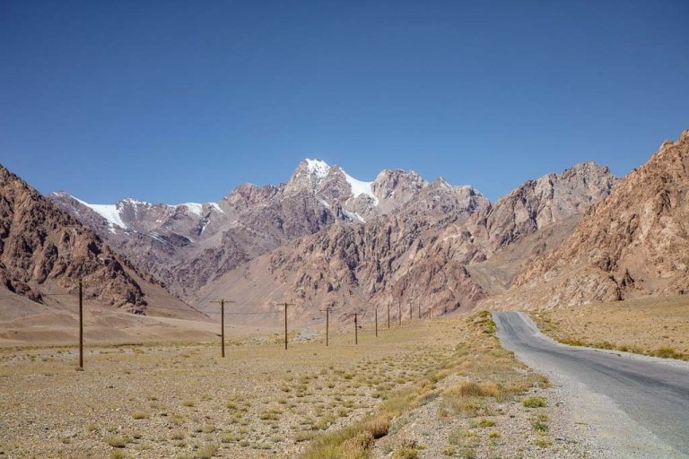
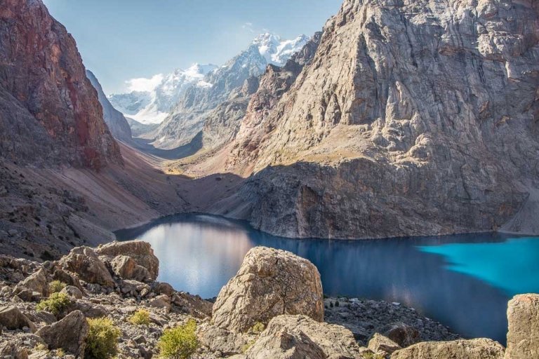
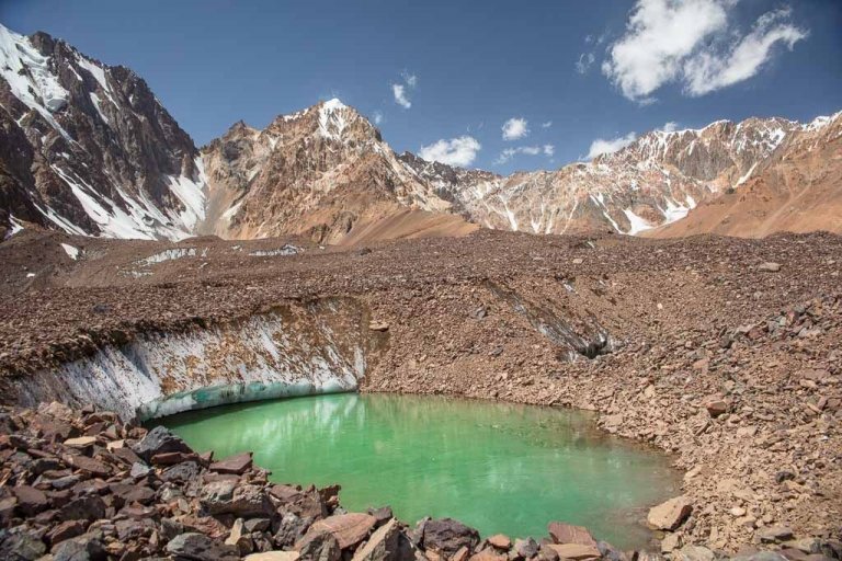
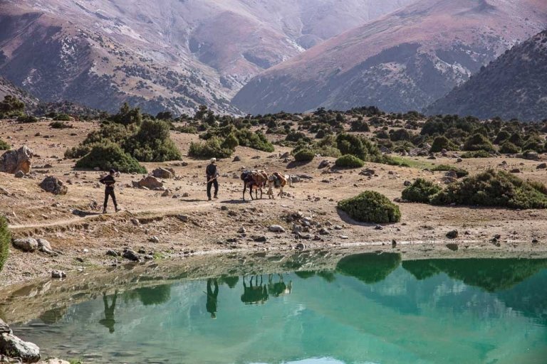
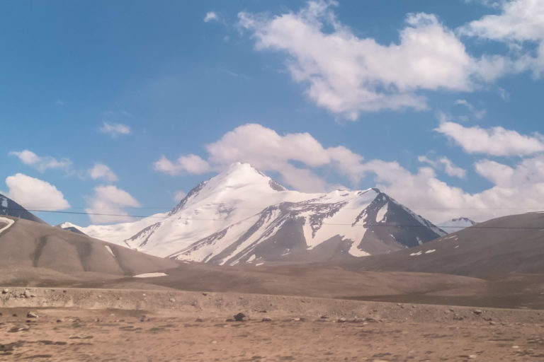
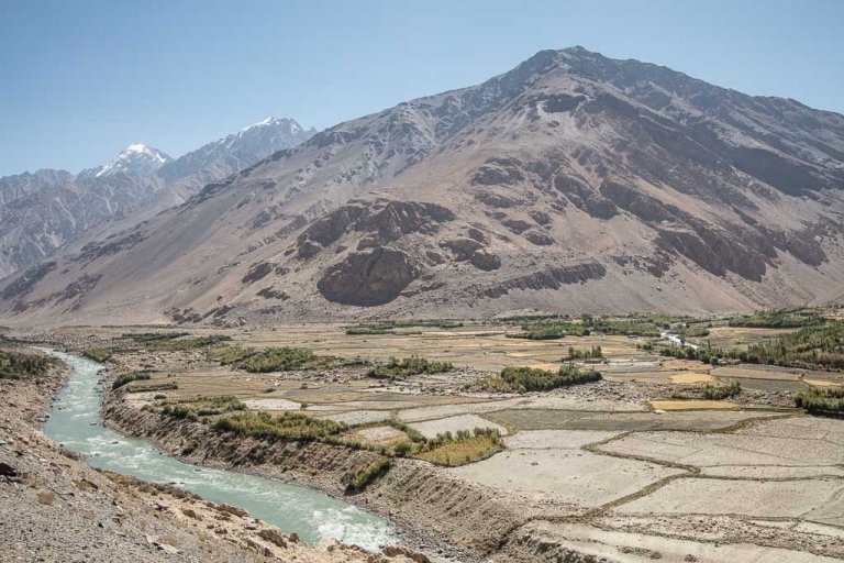
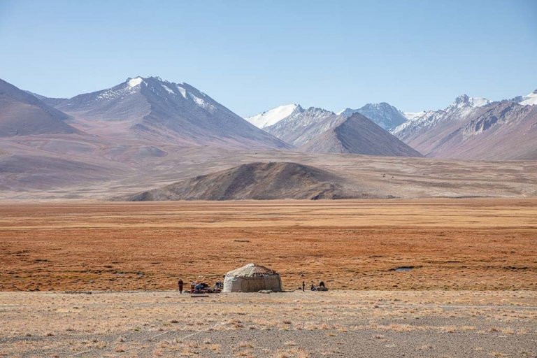
East of Tavildara, along a bumpy dirt track that peters out about 100 km away just south of Peak Ismoil Somoni and just west of Fedchenko Glacier is the village of Langar (not to be confused with the plethora of villages named Langar in Tajikistan), just a hop east of Sangvor. Sangvor is a regional district and Langar is the village from which you can do the Gardan i Kaftar Pass trek to Jelondy from (I’ve done it in reverse).
Sangvor and Langar are an interesting area that’s rarely visited. In Langar there’s a man by the name of Munir who will take in guests and can help arrange transport and guides to explore the area. Munir speaks Tajik and Russian in addition to local dialects, but if you do not, he can phone his nephew who speaks English that is sometimes around Langar or at university in Dushanbe. Munir it a park ranger for Sangvor as well as Tajik National Park.
Plan your Pamir adventure: The Ultimate Pamir Highway Travel Guide
Need help deciding where to include? Check out the 10 day Pamir Highway itinerary
Continue North Toward Karamyk
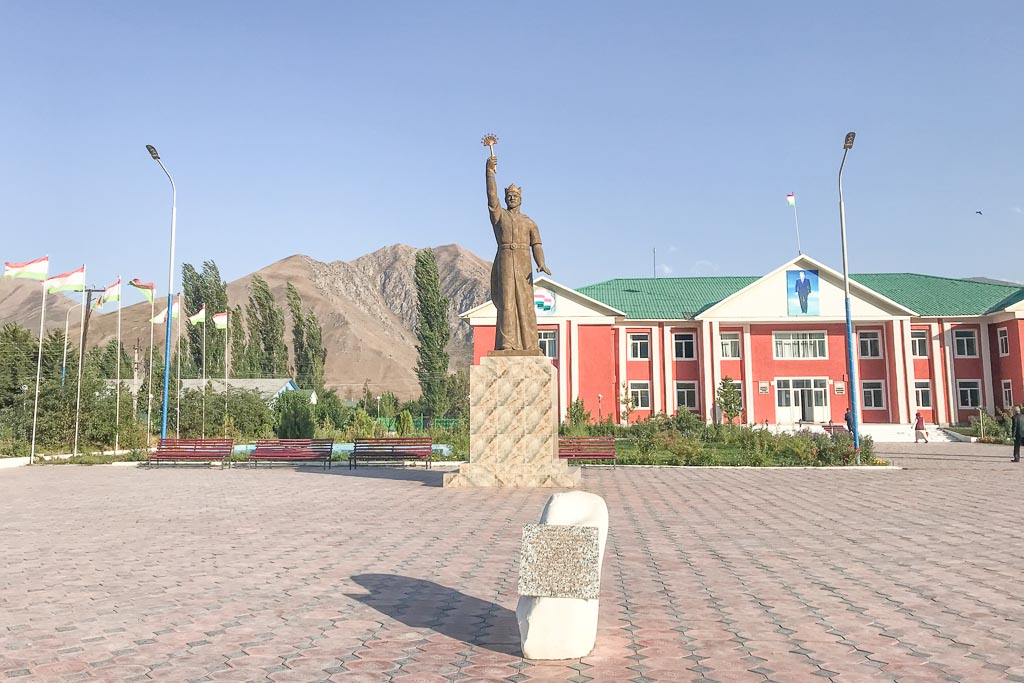
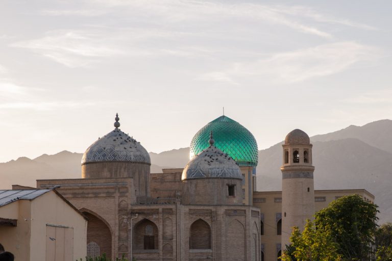
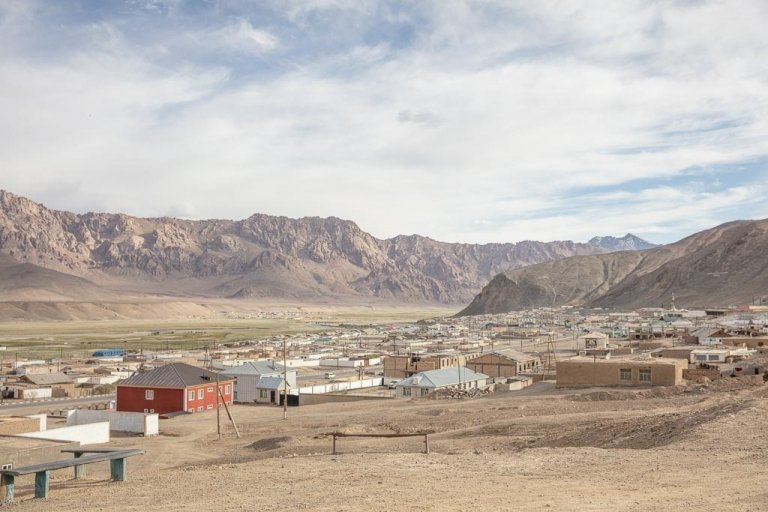
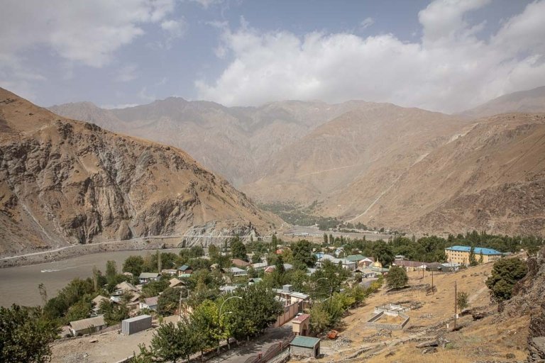
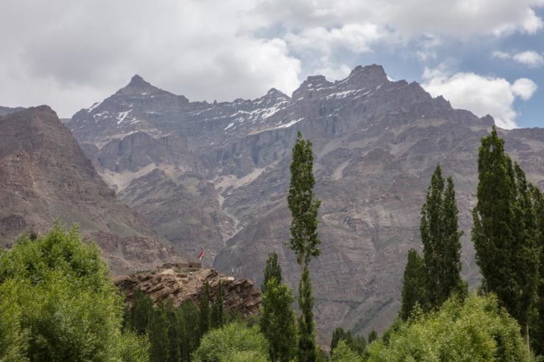
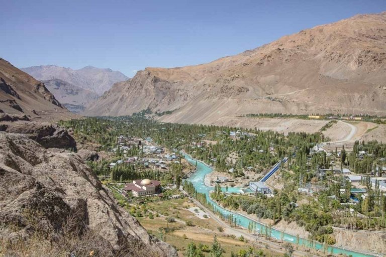
Garm
Garm, recently renamed Rasht, is the administrative center of the Rasht Valley and the largest town. Garm can serve as a decent base for those who want to stay in one place and make day trips to other areas to explore the Rasht Valley or an overnight breaking point for those taking on the M41’s northern route, but I’d recommend Tojikobod over Garm for the overnighter.
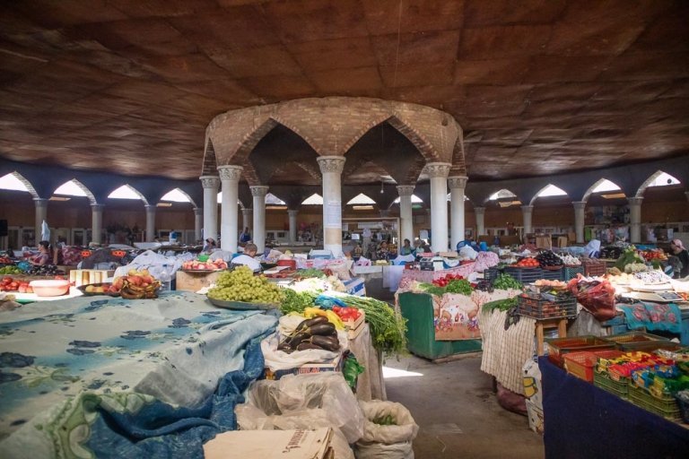
The main attraction within Garm itself is the Central Bazaar.
Jafr
Jafr is located about halfway between Garm and Tojikobod, and along with Tojikobod is one of the most beautiful sections of the Rasht Valley. The main attraction in Jafr is to visit Mirzosho Akobirov’s Jafr Agro Eco Center. Mirzosho has a fascinating collection of grafted fruit trees, an ethnographic collection, and runs a guesthouse here. I haven’t personally visited, but I have friends that did a few years back and raved about their experience.
To get to Jafr, grab a shared taxi from Garm near the bazaar for about 8 TJS.
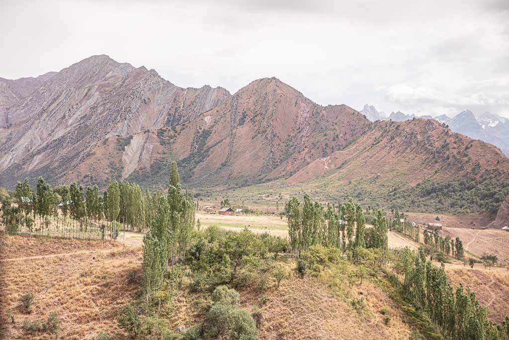
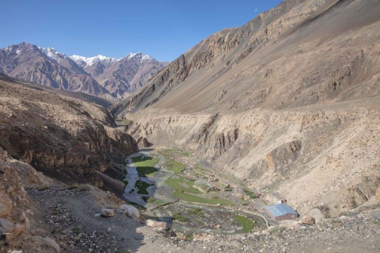
Tojikobod
Tojikobod is set in a gorgeous section of the valley, across the river Vakhsh. This village is a much more atmospheric location to base yourself for further exploration of the Rasht Valley than previously mentioned Garm.
Within Tojikobod there are two shrines to see, Mazar i Fathabad and Hazrat I Bir Pustin, both commemorating local Sufis. Just outside Tojikobod is the Nurshor Valley, which makes a great day trip for spotting wildlife.
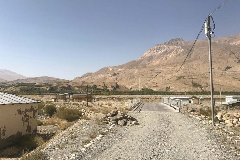
Jirgatol
Jirgatol is the last town before the bilateral Karamyk border into Kyrgyzstan. It’s a small town, but the locals are extremely friendly (we had a crowd of kids in tow the entire time we were there).
There is are a couple of guesthouses in town that most anyone will point out to you. If you wander around the main road you’ll probably be introduced to a man named Islam who can help you arrange transport to nearby Jelondy (not to be confused with the Jelondy along the Pamir Highway near Sassykul). Islam speaks excellent English, and he also arranges and guides trekkers to Peak Somoni Base Camp.
Jirgatol is the jumping-off point for the Gardan i Kaftar Trek.
Looking for other hikes in Tajikistan? Check out the 10 best treks in Tajikistan
Get Off The Beaten Path
Yakhsu Valley
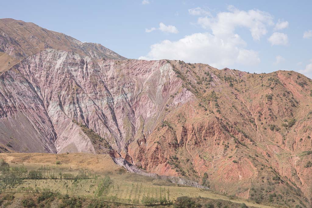
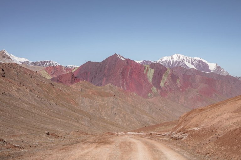
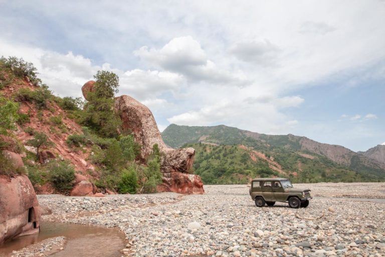
From Taviladara there’s a rough 4×4 track that swings south and takes you to Khovaling, a small town in the Baljuvon District of Khatlon Region. Seldom a tourist makes it out here to the Yakhsu Valley, but the area has some wild geology worth the detour for.
Very few people, even Tajiks know about the Yakhsu Valley. Your best bet to visit would be to head to Tavildara or Khovaling and hire a local driver to take you over the pass and along the valley. If you have your own 4WD, understand some Tajik or Russian and are ready for a breakdown or ten you can take on this adventure independently.
The road is often flooded or covered in landslides in spring.
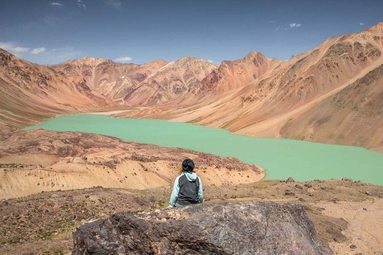
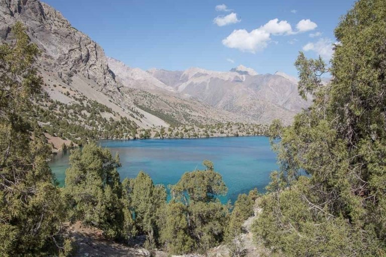
Sar i Khosar Nature Reserve
From Khovaling it’s possible to continue onto the Sar i Khosor Nature Reserve via the town of Baljuvon to explore the rarely visited area and its interesting rock formations. We were leaning toward heading to Sar i Khosar and Childukhtaron after our trek over Gardan i Kaftar Pass, but after meeting a local who knew of both of the reserves decided not to when he told us that you need at least a week to really explore the area (I had about 4 days to get Grant back to Dushanbe), so ultimately decided to save it for another time. Surprisingly, there is a resort just outside Baljuvon near the Mullokoni Waterfall, book a room here.
Read more information about visiting in my guide to Sary Khosar Valley.
Childukhtaron Reserve
Another possibility from Khovaling is taking the rough mountain road to Childukhtaron (40 Girls) Reserve to explore the jagged rock pinnacles the reserve is named after, or to hike into the Hazrati Shoh Range.
Read more in my guide to Childukhtaron.
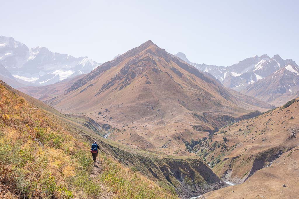
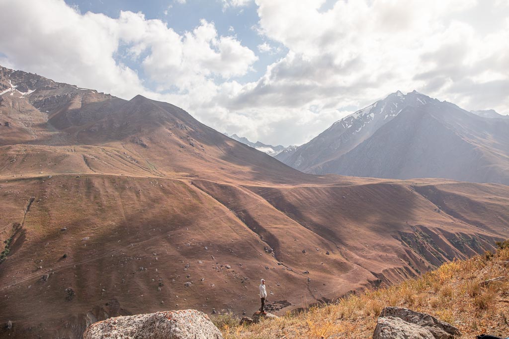
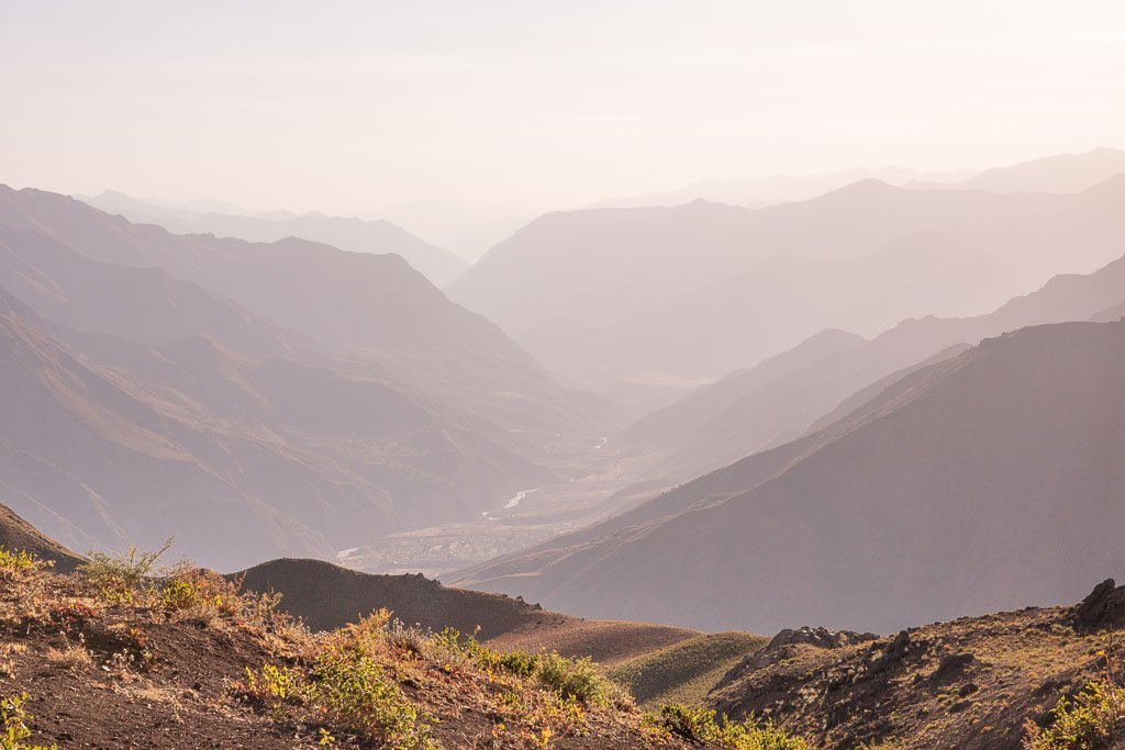
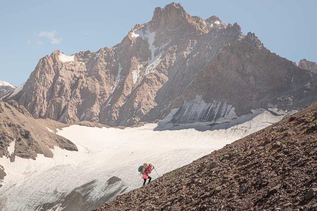
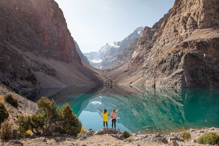
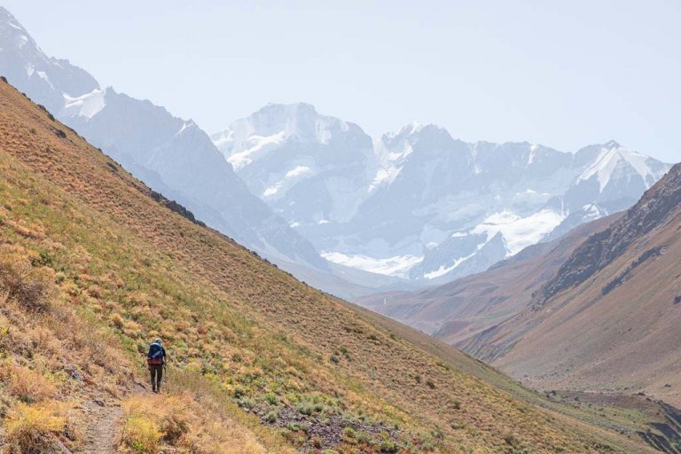
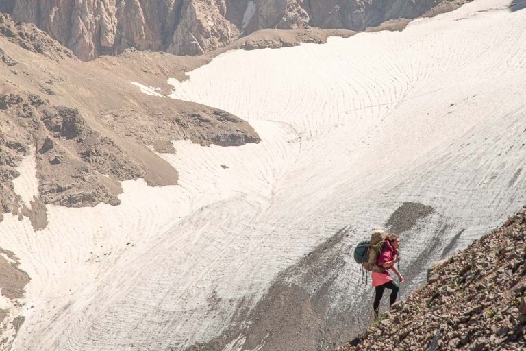
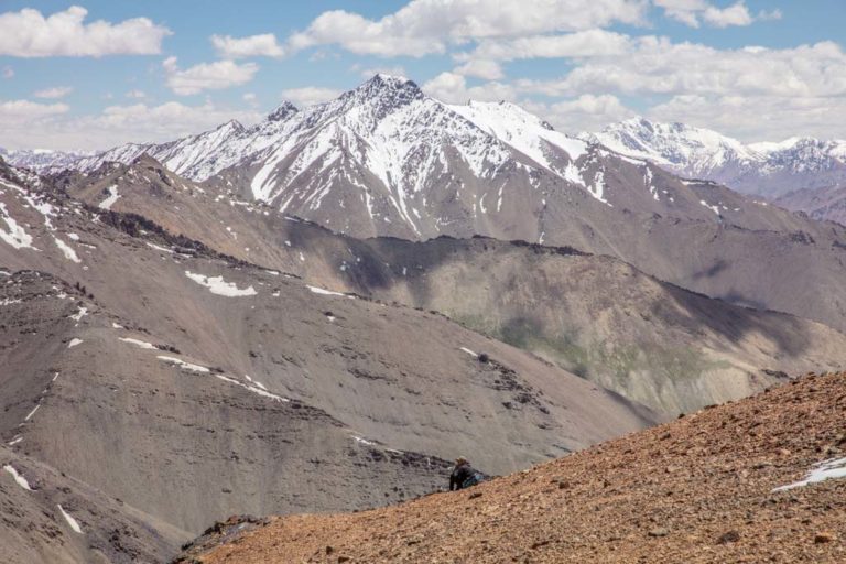
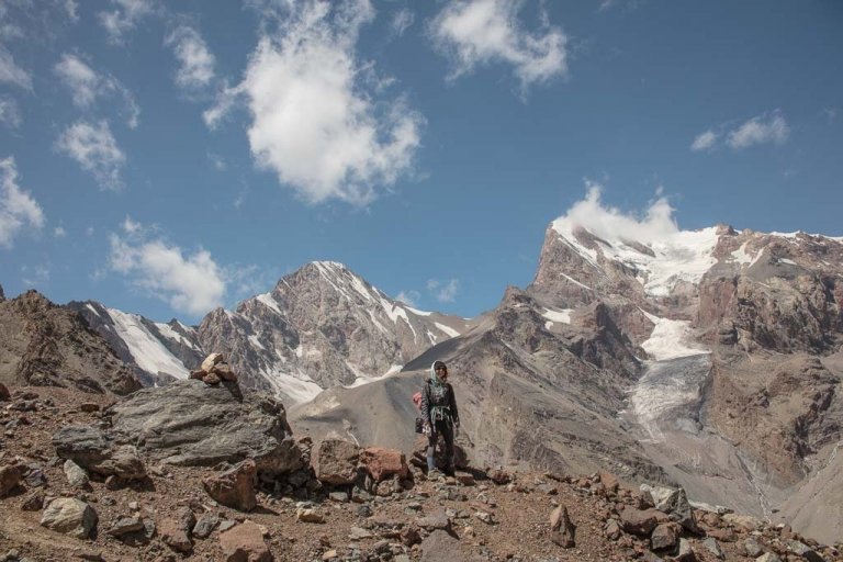
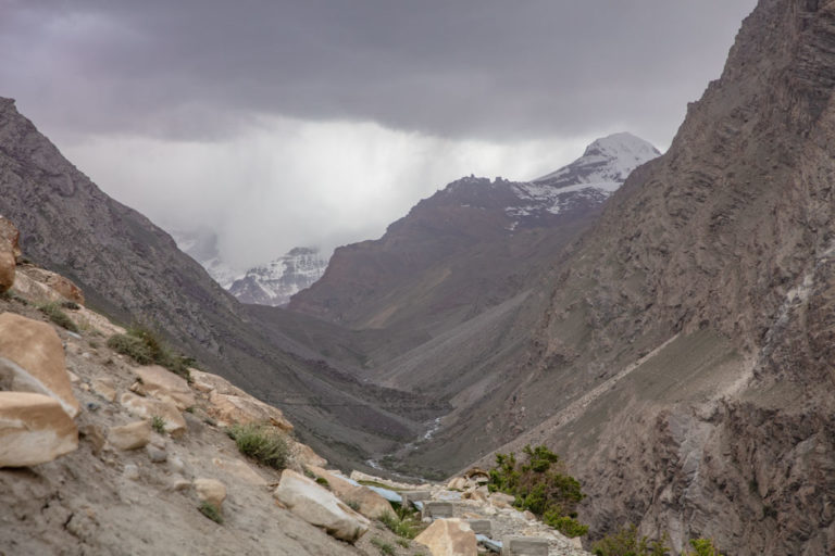
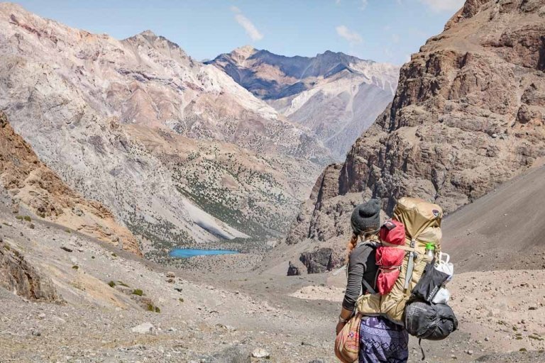
Trekking In The Rasht Valley
Trekking in the Rasht Valley area is best during the late spring and early summer when the passes are accessible and the wildflowers in full bloom (not in the fall when I visited). Many parts of the Rasht Valley, as well as the neighboring Sangvor area, were heavily landmined during the Tajik Civil War, so knowledgable local guides are highly recommended on most routes.
I took my ex (who isn’t too fond of hiking and on his first trip to Tajikistan) to take on the Jelondy-Langar Trek over Gardan i Kaftar Pass, which I would say is possible sans guide (we did it on our own), so long as you’re an experienced trekker who is comfortable route finding and reading maps. There is a stretch of the Obikulika River that still has active landmines, though there are signs marking the area. Just don’t stray much off-trail through here.
Plan your trek over Gardan i Kaftar Pass
If you do plan to go at it on your own, I’d recommend purchasing Jan Bakker’s Trekking in Tajikistan book that does give a trekking description of this particular hike. Though do note that some things have changed in regards to the route and trail since it was researched.
Is Tajikistan safe? Read up on it here
Recommended Gear For Trekking In The Rasht Valley
- Inreach Explorer+
- Backpack (I personally recommend the Ariel 65 for women)
- Hiking boots (My favorite is the La Sportiva Nucleo High GTX)
- Waterproof sandals
- Katadyn water purifier
- Sleeping mat
- 3-season tent
- Hydration Pack
- Sleeping bag cold rated to -6ºC/20ºF
- Campstove and Cooking set
- Silicone squeeze tubes (for cooking with sauces, olive oil, etc.)
- Propane/butane canister (available for purchase at Greenhouse Hostel in Dushanbe)
- Trekking poles
- Headlamp
- Trekking in Tajikistan by Jan Bakker (Written by a friend and includes the Fann Mountains, Yagnob Valley, and Pamir)
Maps
- Southern Tajikistan Map by Markus Hauser
Guide Books
- Tajikistan and the High Pamirs by Robert Middleton & Hue Thomas. This is a huge book, but it has so much good info on Tajikistan from history, great-game stories, travel information, and more.
- Bradt Tajikistan by Sophie Ibbotson & Max Lovell-Hoare. The most complete travel guide to Tajikistan
- Central Asia by Lonely Planet. Handy to have with you, although don’t necessarily treat it as a bible. Things rapidly change and the currency can fluctuate so it’s not always dead on. A new edition published in 2018 and I heavily question whether the writer in charge of the Tajikistan section had ever stepped foot in the country, you’ve been warned.
- The Central Asia Phrasebook by Lonely Planet I found this to be a handy item for Tajik, Russian and Kyrgyz phrases, not so much for the Wakhi phrase section.
Safety
Despite my hike over Gardan i Kaftar Pass being the only time I’ve ever been stolen from (and nearly molested by a pervy shepherd, but near-sexual assaults are something that I’ve fought away from countless times at home and on the road), I wouldn’t say that the Rasht Valley is an extremely dangerous place that should be avoided. There are special considerations that need to be made but overall I don’t think the Rasht Valley is inherently more dangerous than other places in Tajikistan, Central Asia, or other regions of the world.
Your biggest concern should probably be with the fact that this was a heavily landmined area during the Tajik Civil War. Some landmines have been removed, but know that there still are unexploded ordinances.
Many areas with undetonated landmines are marked, but that isn’t necessarily a guarantee of where and where not has been cleared. That is why, if you do plan to do any trekking in the Rasht Valley area I recommend a local guide, or taking extra care to not leave the well trodden shepherd trails.
As for theft, I did have my only hiking boots stolen one night one of my trek that began from the Rasht Valley. Like every other night I camp, I took off my boots and left them in the vestibule of my tent, side by side with my Grant’s hiking boots. I awoke in the morning to no shoes.
We were in the Obikulika Valley with several shepherding camps nearby, so it’s safe to assume a shepherd made off with them in the night. It was extremely windy that night, so stealing them without us hearing was quite easy. I’d also like to point out that my ex’s neon rainbow colored Scarpa hiking boots were not stolen, but my low-key, brown, rather masculine hiking boots were stolen.
We did finish the trek but I did it in a pair of Grant’s treadless tennies that are like 6 sizes too big. It was either that or my crocs sandals so ??
But needless to say, there were at least 457 times I really could have used my hiking boots over the next three days, that were now likely on the feet of a shepherd, riding a donkey with his toes, secured in women’s footwear, dragging in the dirt.
Now for uncle pervy. Grant was back at the tent and I was out having a look around in the morning. I ran across a shepherd that we had met the day prior who waved us off the trail in landmine alley and invited us to camp nearby him. We chatted with him for about 30 minutes and let him know we would be carrying on a little further before dark, but thanked him for the offer.
The next morning started off similarly. He invited me for tea, I thanked him but declined as I was on a hunt to try and find my boots because I don’t know, maybe a shepherding dog had made off with them or something (me trying to be hopeful).
He then pushed me down, trying to kiss me and climb on top of me. Luckily he wasn’t a very big man, and I’ve kicked an ass or three in my time so I got away.
Grant, blissfully enjoying the morning light from our tent (he has no Russian or Tajik language skills so it made sense for him to stay behind). And if you think I deserved it for dressing like a western slut, I was wearing a knee-length tunic, leggings, a winter jacket with the hood pulled up, wool socks, and crocs. Now, I mean those socks n’ crocs can be quite tantalizing, but I highly doubt it was anything to do with me and the fact that he was just a crusty old perv.
Have Any Questions About The Rasht Valley?
Ask in the comments section below.
More Posts from Tajikistan:
A Simple Guide To Central Asia Visas
Istaravshan Travel Guide + 9 Things To Do In Istaravshan
The Best Road Trips In The World
7 Tips For Solo Female Travel In Central Asia
10 Reasons To Visit Tajikistan
Bartang Valley Guide
A 10 Day Pamir Highway Itinerary including the Wakhan Valley

Ishkashim Border Crossing Between Tajikistan & Afghanistan
Khujand Travel Guide + 14 Things to Do In Khujand
The Best Restaurants In Dushanbe
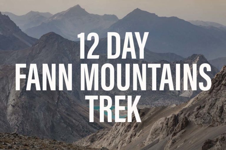
Fann Mountains Trekking Expedition, Tajikistan June 12-23, 2024
The Ultimate Tajikistan Travel Guide

12 Day Pamir Highway Expedition June 25-July 6, 2024
25 Day Tajikistan Expedition June 12-July 6, 2024
Trekking The Haft Kul in Tajikistan’s Fann Mountains
Two Week Tajikistan & Uzbekistan Itinerary
Tajikistan Itinerary For 1-4 Weeks
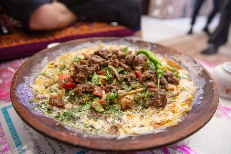
Must-Try Tajik Food: Best Food in Tajikistan
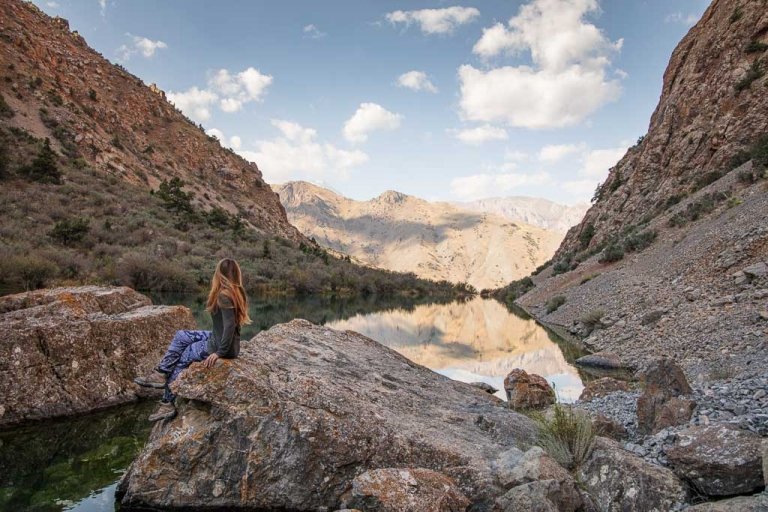
A Guide To Tajikistan’s Fann Mountains
The 10 Best Hikes In Tajikistan
Panjakent Travel Guide + 6 Things To Do In Panjakent, Tajikistan
17 Things To Do In Tajikistan
A Beginner’s Guide To Central Asia Travel: Discover The Silk Road
Panjakent-Samarkand Border Crossing Between Tajikistan & Uzbekistan
Rasht Valley, Tajikistan
How to Cross the Shirkhan Bandar Border Crossing Between Tajikistan & Afghanistan and get an Afghan Visa on the Border
The Gardan i Kaftar Hike In Tajikistan’s Rasht Valley
A Day Trip To The Taboshar Uranium Mines in Istiklol, Tajikistan
A Day Trip to Madiyan Hot Springs, Tajikistan
Windswept Desolation In Karakul, Tajikistan
Gumbezkul Pass Hike, Tajikistan
Murghab Travel Guide + 4 Things To Do In Murghab, Tajikistan
The Beautiful Bolshoi Allo Lake In Tajikistan’s Fann Mountains
Sarazm Ruins, Tajikistan: The Oldest City in Central Asia
How To Get To Khafrazdara Valley, Tajikistan
Qala i Khumb Travel Guide, Tajikistan
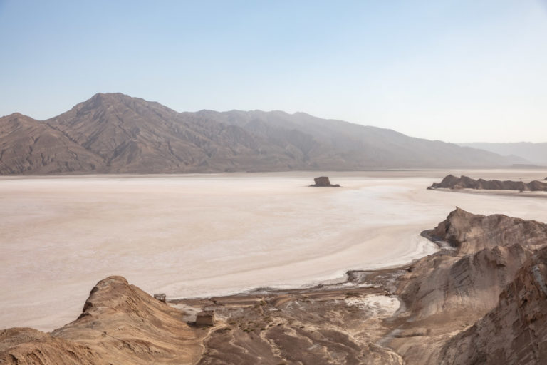
A Giant Salt Flat in Tajikistan? Welcome to Akhkon
Crossing Chimtarga Pass
How To Get To Timur Dara Lake, Tajikistan
A Guide to the Shokhdara Valley, Tajikistan

How To Get To Lake Sarez, Tajikistan
Trekking to Pik Engles Meadow in Tajikistan’s Wakhan Valley
Across Tajikistan In 80 Photos
Climbing Kyzyldong in Tajikistan’s Pamir Mountains
How To Get To Hisor Fort, Tajikistan
Crossing Kyzyl Art Pass Between Tajikistan & Kyrgyzstan
Tajikistan Border Crossings
Khorog Travel Guide + 7 Things To Do In Khorog
Is Tajikistan Safe? The Short Answer: Yes
Solo Female Travel in Tajikistan
Tajikistan Visa Guide: How to Get a Tajik Visa
The Tajik Wakhan Valley Travel Guide
Jizeu Trek: Tajikistan’s Best Overnight Hike In The Pamirs
10 Reasons to Visit The Pamirs
Yagnob Valley Trekking & Travel Guide
Iskanderkul & Sarytag Travel Guide, Tajikistan
Hike The Lakes Loop in Tajikistan’s Fann Mountains
10 Things To Do In Dushanbe + Dushanbe Travel Guide
Crossing The Qolma Pass Between Tajikistan & China
The Ultimate Guide To The Pamir Highway
Crossing Dukdon Pass In Tajikistan’s Fann Mountains
South Aral Peak Hike, Tajikistan
Visiting the Sary Khosar Nature Reserve, Tajikistan

How to Visit Childukhtaron, Tajikistan
Eastern Pamir Travel Guide
10 Off The Beaten Path Destinations For 2021
Travel with Me to China, Tajikistan and Pakistan in 2018!
Impresionante tus relatos y paseos. Muy bien informados con muchos tips detallados para que el viaje sea más fácil. Conocés más Tayikistán que los propios tayikos 🙂 Saludos desde Argentina. Utilizaré algunos de tus datos en mi corto viaje a Tayikistán.
Felicitaciones !!
Gracias, que lo pases bien en Tajikistan!